Feeds:
Posts
Comments

Archive for the ‘Routes & Maps’ Category

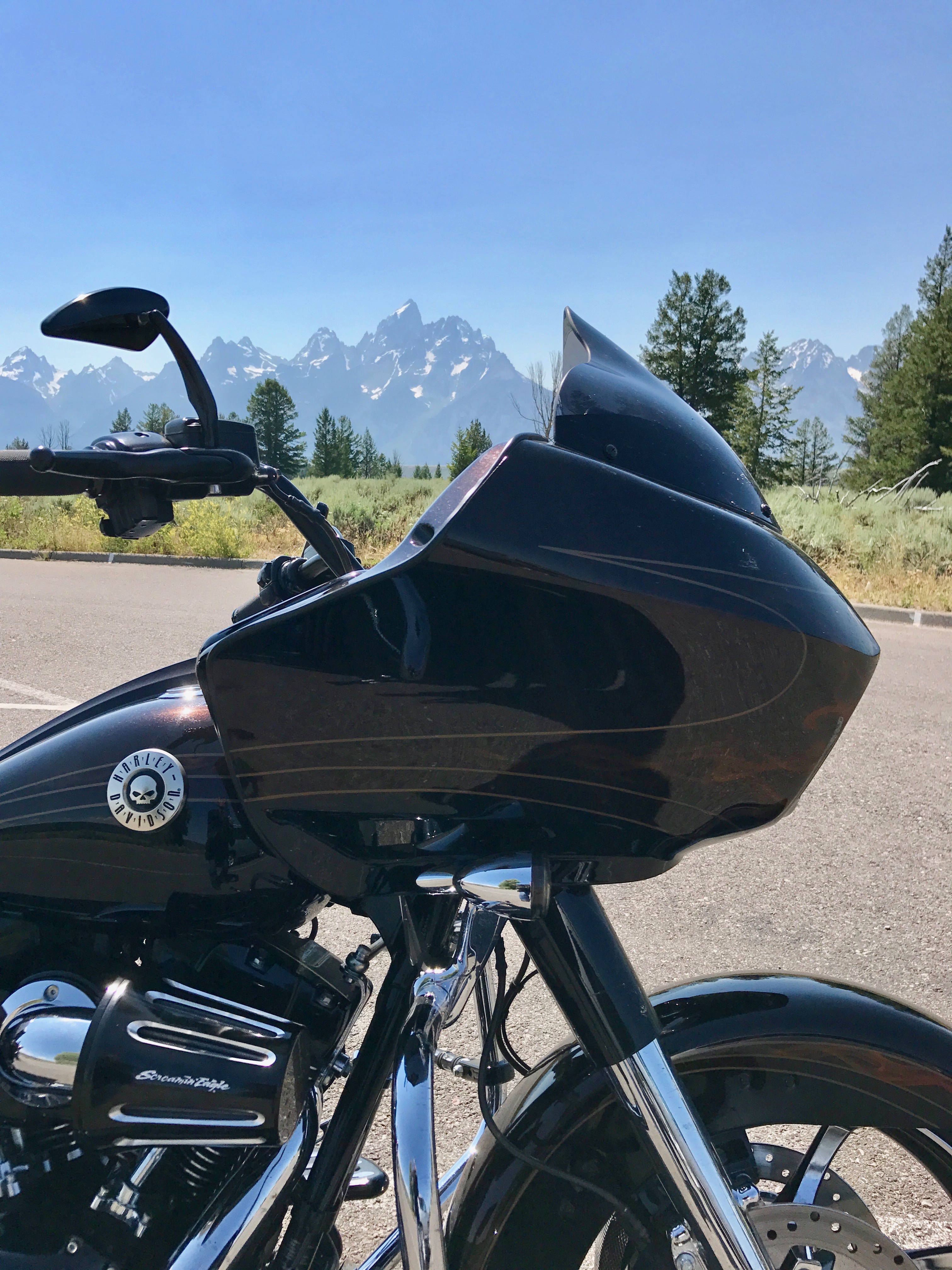
Many of today’s technology-driven, electrification, and social media-obsessed adults don’t relate as much as I do to the joy of the wind in your face on a petrol-propelled motorcycle.

Their loss in my opinion.

But, for those who get it, they know that Harley-Davidson enthusiasts like to get together, get to know each other and do a lot of riding.

For those of us who live in Oregon, we clearly know that we have some of the best riding in all of the U.S., which means this year we get to share this gem of a state at a National H.O.G.® motorcycle rally.

I’m talking about the Oregon Volcanoes H.O.G. Touring Rally happening September 11-15th. For those unfamiliar with Oregon, it’s a perfect time of year for riding, with mild temperatures, little chance of rain, and the foliage season begins. Adding to that, the Pacific Northwest is increasingly known for its craft beer, coffee shops, vibrant music and food scenes which is reason by itself to visit the state.

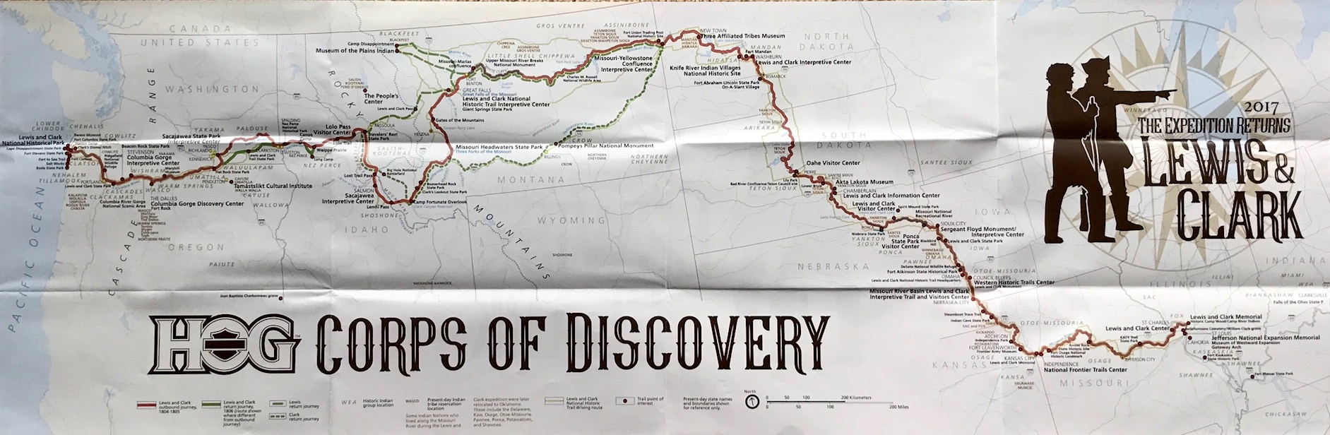
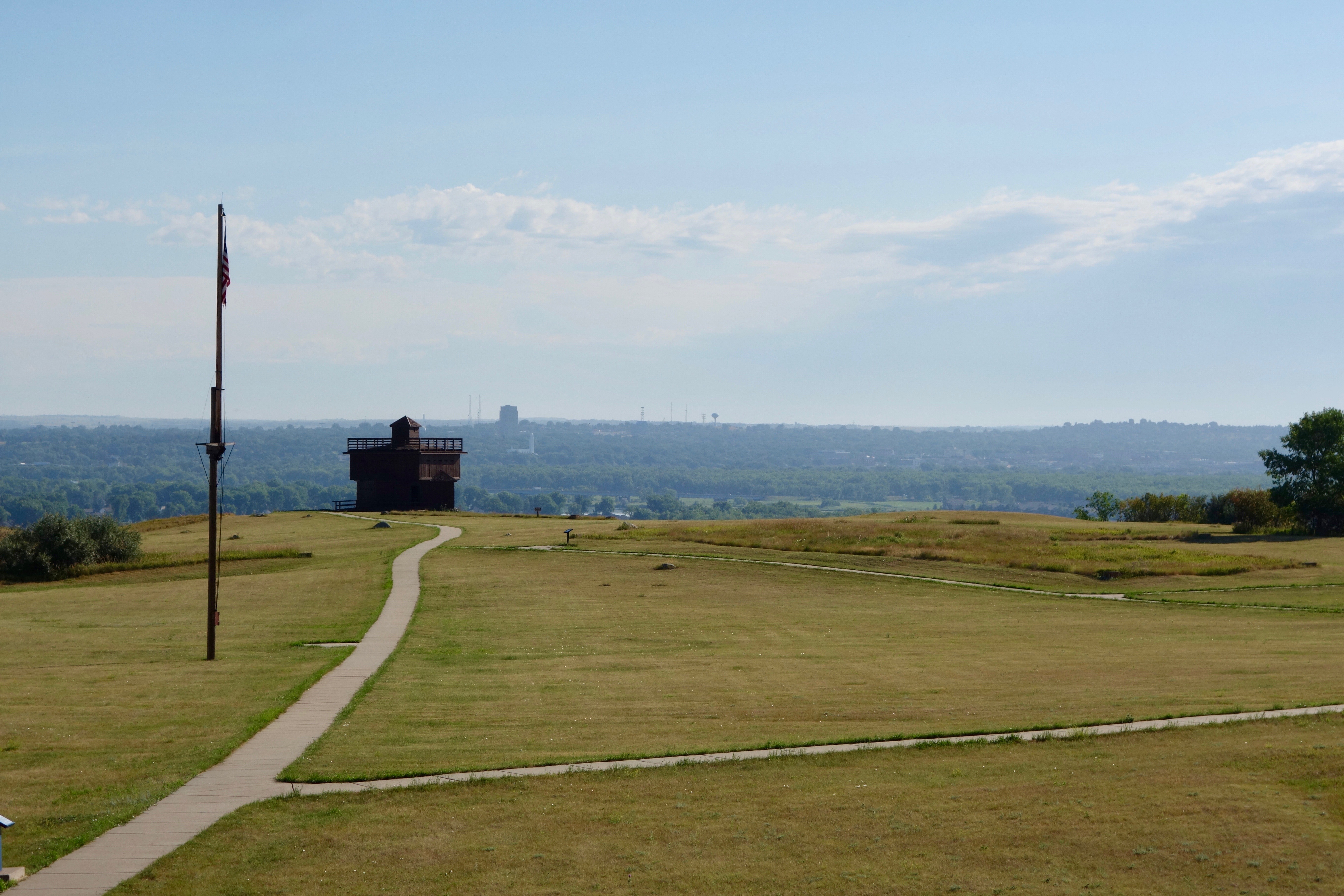
The last time there was a National H.O.G. Rally — that was started out hosted in Oregon — was back in 2017 for the Lewis and Clark; The Expedition Returns. That ride basically followed in the footsteps of Lewis and Clark’s 1805 expedition in search of the Northwest Passage, from Seaside, Oregon to St. Charles, Missouri. If you want a little sample of that adventure, I detailed the adventure HERE.  If you’re looking for even more information about Lewis and Clark, visit the National Geographic site dedicated to their journey HERE.

50 Rides, One Nation

It’s been my experience after attending a few National H.O.G. events, they are a class act.  The local dealers often host evening events and the route information and swag are of high quality.  In addition, the H.O.G. planners (Bill Davis • Rally Coordinator) make it very simple to participate and have a great experience!

At present, the Oregon Volcanoes Touring Rally has 190+ H.O.G. Members and guests registered.  Keep in mind, this isn’t a “group ride” where a couple hundred bikes depart simultaneously every day with a ride captain.  Riders are free to forge their own departure times and routes (with solid guidance on scenic location stops and daily endpoint events) while riding at your own pace.

The ‘Volcanoes’ rally will start on the eastside of Portland, OR with a ride along the Columbia River Highway to the scenic Multnomah Falls viewpoint. Traveling a little farther and it’s a picturesque view of Mount Hood, the first of eight volcanos on this ride. The tour will then head north to an active stratovolcano, Mount St. Helens in Washington State, at a viewpoint which is also one of the stops for the 10 Rides for ‘21 H.O.G. challenge.

Mount St. Helens Loop

You might recall that the 10 Rides for ’21 is an annual H.O.G. member challenge featuring 10 great destinations throughout the country, along with a recommended scenic route for each. At this rally, riders will also have the option of picking up one of the 50 Rides, 1 Nation H.O.G. challenge on the Columbia River Highway at the Vista House in Corbett, OR. That’s two H.O.G. challenge stops completed, in less than 100 miles into your rally! The tour will loop back around to the westside of Portland for the first night on the road with a hosted event at Paradise Harley-Davidson.

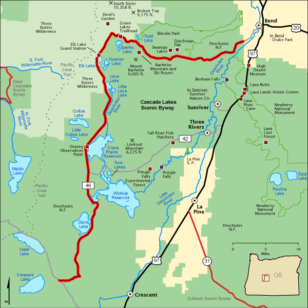
On day-2, the tour will pass through the Opal Creek Wilderness and have spectacular views of Mount Jefferson, Three Sisters and Mount Bachelor to the eastern side of the mountains ending in Bend, OR for a hosted party and meal.

On day-3, the tour takes the route west towards the coast and the cool breezes of the Pacific Ocean and the coastal community of Coos Bay. The tour will ride by Newbury and Mount Mazama Volcanos.

On day-4, the tour will ride by the Mount McLoughlin volcano and will visit Klamath Falls before ending the rally with a hosted meal, party and closing ceremony in Medford, OR.

There will be a total of five hosted stops planned at Harley-Davidson dealerships along the tour route. Check out the H.O.G. website if you’ve yet to register and want to join the tour HERE.

It should be a great Oregon tour, with a side trip into Washington and a riding route that provides twists and turns and follows many of the region’s noteworthy volcanos.

Photos courtesy H.O.G. and Harley-Davidson

All Rights Reserved © Northwest Harley Blog

Read Full Post »

U.S. Route 50 — NV Hwy 50 — “The Loneliest Road in America”

I’m referring to U.S. Route 50, a black ribbon that stretches more than 3,000 miles across the country, from Ocean City, Maryland, to West Sacramento, California.

It’s called “The Loneliest Road in America” for a reason and when you enter Nevada at the Utah state line it travels across 500 miles of Great Basin Desert.

This was our early summer road trip along the historic Pony Express Trail en route to the Road Glide National Rally (aka: “Sharkweek“).

Pony Express Trail

The RoadGlide.org is a community dedicated to all Harley-Davidson Road Glide owners and enthusiasts.  It’s an awesome group of people that like to discuss performance, builds, accessories, mods, specs, troubleshooting, maintenance, and much more.

The like minded gather every year in a different location to experience the roads of the local area and celebrate the ‘Glider’ camaraderie. I was granted grandfather rights to the club having previously owned a Road Glide (aka: Brownshark), but they are a most welcoming group to any rider. Besides, that tradition of featuring a bonfire of anything other than Road Glides stacked, burned and melted together amid cheering crowds is long gone!

It had been eight years since I last attended a Sharkweek event. My first was in 2013 at St. George, Utah for number III, but this was number XI and on the west coast near beautiful Lake Tahoe in Minden, Nev.  The host hotel was the Carson Valley Inn & Casino.

Hotel Nevada – Ely, NV

But, I’ve gotten ahead of myself.

We departed a day prior of the now infamous June 26th heat dome that enveloped the Pacific Northwest, driving temperatures to extreme levels — in Salem, Ore., about half-hour southwest of Portland, it reached 117 degrees.  We’re unaccustomed to that type of oppressive summer heat, but the group headed east for Boise, Idaho anyway where temperatures were a bit cooler and only slightly above 100 degrees.  We headed to The Reef for dinner where the patio is great, the food is tasty, dual bars so the lines are short and there is always a good band playing. Stop in there if you ever have an opportunity.

The next day we rode out early en route to Twin Falls and were passed by just about everyone scooting along I-84 well in excess of the posted 80 MPH speed limit except for an occasional semi. We continued south on US-93 into Nevada where the temperatures continued their relentless rise, but when we finally stopped at Hotel Nevada in Ely, Nev., we were met with cooler weather.  Go figure!

Established in 1929, the Hotel Nevada became Ely’s premiere dining and lodging destination. It is an historic property with a lot of charm down to stars in the sidewalk to celebrate those who had stayed there from Jimmy Stewart to President Lyndon Johnson. We were worn down a bit from the heat so the fact that the room was small and the bathroom even smaller didn’t matter when ready to sleep.  The lobby is a casino which other than the clouds of cigarette smoke was not a big deal and we enjoyed the free breakfast in the lobby at the Denny’s restaurant before departing on the Gold Rush–era highway that is part of the West’s last frontier.

Nevada Highway 50 — America’s Loneliest Road

America’s Loneliest Highway — crosses by or through several communities, a handful of mountain ranges, a national park, and one reservoir, where wild horses roam free. There’s life, yes, but not something familiar for many. It’s a place where the lines between an ‘ol John Wayne Western movie and everyday life blur, and where ghost towns bleed into semi-living ones.

We had our official “survival guide” passport book and proceeded to collect stamps from the various businesses and which the governor of Nevada will supposedly sign if at least five businesses stamped our passports. The 287 mile-stretch of U.S. 50, running from Ely to Fernley, Nev., passes nine towns, two abandoned mining camps, a gas pump and the occasional coyote.

Sage Brush Ocean — Nevada Hwy 50

We passed a number of “Loneliest Road” signs along this black ribbon where the occasional business on the Route displayed a “I Survived Route 50” sign in a window covered with layers of dirt and grime. We rode through more than a dozen mountain ranges as we traversed the state, climbing up into the red rock heights, then dipping down into the patchy desert of the hot valley floor.

So this was it. I wondered, when first reading about Route 50, why a AAA official was so concerned about anyone traveling it and why Time Magazine wouldn’t recommend it. The journey does require a specific skill set: sitting for a very long time on a hot motorcycle saddle, knowing where the next gas station is amid the desert’s FM fuzz and more importantly, knowing how to be alone inside your head. Way inside being the operative word there in a vast “sagebrush ocean”.

The posse was adventurous, had too many Gatorade drinks and survived the Route 50 experience.  Not just tourists, but rugged participants that rode away with stamps and bragging rights of our achievement along with the real-deal memories.

We finally came to rest at base-camp in Minden, Nev., at the Carson Valley Inn & Casino and picked up our registration packet and incredibly nice bag of swag for the multi-day Road Glide National Rally (“Sharkweek XI”).

Next up is our rides in the area at Yosemite National Park via Tioga Road (Highway 120) and around Lake Tahoe before returning home through Lassen National Park.

Photos taken by the author.

All Rights Reserved © Northwest Harley Blog

Read Full Post »

Montana Border on Highway 200

Last month I posted about plans to ride through Glacier National Park.

I started making plans a couple of months prior to the ride looking for the slowest, curving roads with mountains and throwback motel stopping points to minimize pandemic exposure.

The reopening of Montana’s tourism amenities and services started in early June, which meant they were open a couple months prior to our arrival, with the exception of the Blackfeet Indian Reservation which was closed “until further notice.”  Canada also blocked all non-essential travel into the country so any mini-tour loop into BC or Alberta was off limits this trip.

It turns out that 2020 was a record-breaking year for the fact that there were NO forest fires during the days we visited the park to disrupt the spectacular views. There has been a fire in Glacier National Park almost every year of its existence with the exception of 1964 as the only year with no fires on record. Fires are a naturally recurring part of the forest lifecycle, but seeing Glacier with pristine clear air was an exceptional gift this time.

We traveled northeast crabwise across Washington state and spent a night in Sandpoint, on the northern tip of Idaho. It’s located on the magnificent 43-mile-long Lake Pend Oreille, surrounded by the Selkirk and Cabinet mountains. The next morning we traveled east on Highway 200 alongside the lake, then alongside the Clark Fork River.  We made a breakfast stop at a terrific family owned bakery in Clark Fork, called The Pantry.

Once we crossed over into Montana, we took a short detour to the remote end of Sanders County and traveled over the new $13.5 millon Heron Bridge.  It replaced a 95-year-old, one-lane bridge connecting Montana Highway 200 to the community of Heron. The original bridge had the ribbon cut on Nov. 23, 1952, but was originally fabricated in California and was already 32 years old when first installed across the river.  It had been deemed insufficient for growing traffic across the Pend Oreille River near Metaline Falls, Washington when it was moved and re-constructed at Heron.

“Sun Road” Glacier NP

After the bridge tour we rode north on Highway 56, Bull Lake Road, which is about 36 miles long and dead ends at Highway 2 just west of Libby. The landscape in the area is very diverse from low elevation timber and lakes to the outstanding peaks in the Cabinet Mountains and Scotchman Peak area.  We rode along the Kootenay River on Highway 2 to Kalispell then north on Highway 93.  We overnighted in Whitefish, MT a gateway to Glacier and a nice resort town. With a mixed array of shops, coffee houses and restaurants it reminded me of Jackson, WY charm.  There are plenty of places to enjoy a Going-to-the-Sun IPA with a great view of the mountains.

Glacier National Park, MT

The Blackfeet Indian Reservation closure created an impediment to traveling the Going-to-the-Sun road through the park and then looping back on Highway 2.

The road/gate entrance to the park was closed at St Mary. An optional route from Glacier north across the Canadian border to visit the Waterton-Glacier International Peace Park was a barrier as well since the Canadian border was closed.

At any rate, we began at West Glacier for a slow out-and-back ride on the 50-mile-long road.  There were incredible views of glacial-carved valleys, jagged peaks and pristine wilderness. A benefit of the pandemic was those famous red busses which departed from Lake McDonald Lodge were shut down and not running on the roads this year.

The Going-to-the-Sun Road was the National Park Service’s first to cross the trans-continental divide. It’s a landscape impossible to adequately describe in words or capture in photos when riding into that ‘big sky’ that Montana is famous for.

The west tunnel–a 197-foot long tunnel features two arched openings that let you look out to Heaven’s Peak and the Upper McDonald Creek valley while behind the handlebars. The Alpine section–is a six percent climb between the Loop and 6,646-foot high Logan Pass. There’s a section of the road called The Weeping Wall. A waterfall cascades 100 feet down, over the rocks and onto part of the road and down the other side of a 4500 foot cliff drop-off.

The Posse

The views! The curves! It’s like a real life painting.

For all its scenic wonders, the “Sun Road” is not without a few negatives: overall, the roads were in good shape and well-maintained, but there were a couple of rehabilitation projects and construction delays can be a major buzz-kill with all the crowds. The speed limit is slow-to-stop with much of the ride quality depending on the crowds and RVs.

The end of our round trip ride took us back into touristy West Glacier, town. Afterward we headed back to a Whitefish pub (via a motel shuttle) to try out a flight of their whiskeys and celebrate the completion of a beautiful ride.

Glacier is a place to be savored and a place to come back to again and again. It was great to get a break from the relentless protest, COVID-19 media drum beat and to reconnect with the land by motorcycle.

Photos taken by the author. 

All Rights Reserved (C) Northwest Harley Blog

Read Full Post »

Riding the Going To The Sun Road – Glacier National Park

From Acadia to Zion our country’s most spectacular landscape treasures are protected inside the parks.

No map or brochure can prepare you for that first motorcycle ride and peering out over a guardrail at snowy mountain peaks, waterfalls that flow down the valley through the forests, and end in a clear blue lake carved out by glaciers. The mountain mornings always have a bite of cold as the sun takes its time to wake, while meandering through the incredible scenery.

I’m talking about National Parks in general and specifically Glacier National Park, Montana which in my view shines above the rest.

Glacier National Park – Going The Sun Road

It never gets old and I plan to ride through the million-acre paradise later this month and take a COVID-19 mental diversion through the park. Montana has plenty of mountain roads where motorcyclists can ride and absorb the landscape, but the crown jewel is the Going-to-the-Sun Road. It crosses the Continental Divide carves through the steep grade of rock and forest with roughly 50 miles of sweeping curves and hairpin switchbacks along with an occasional tunnel passage through the mountain.

The national parks are such a gift, one we’ve given to each other. One we’ve inherited and, with luck, will pass down to the generations that follow us.

Speaking of paying it forward…

Going To The Sun Road

The National Park System comprises 419 national park sites, but only 62 of them have the “National Park” designation in their names. The other sites fall into different National Park System categories like National Historic Sites, National Monuments, National Seashores, National Recreation Areas, and others.

You might be surprised to learn that the National Park Service accounts for 84 million acres of land at more than 400 different sites, but as of 2019, they were due for $11.9 billion (that’s a B!) in deferred maintenance and repairs. Fortunately, the current administration recently signed a bipartisan bill (Great American Outdoors Act) that will pay for repairs at national parks, permanently finance the Land and Water Conservation Fund (LWCF) and in addition will create a lot of jobs.  The bill directs up to $6.65 billion to priority fixes and up to $3 billion for agencies such as the Fish and Wildlife Service. In addition, the bill will allocate $900 million each year to the conservation fund. The program – which has existed for half a century – has historically been plagued by funding shortfalls.

Lake McDonald

The Great American Outdoors Act enacted last week is clearly the most consequential funding for national parks, wildlife refuges, and public recreation facilities in U.S. history since the conservation legacy of President Theodore Roosevelt in the early 1900s.

As motorcycle enthusiasts, we can take heart that there’s always going to be those historic chalets, lodges, and miles of tarmac with beautiful landscapes that meander their way through the firs, aspen, and stone.

Photos taken by author.

All Rights Reserved (C) Northwest Harley Blog

Read Full Post »

Highway 395 View of Mono Lake

Back when modern life swallowed me up with bills, paperwork, pick-ups, drop-offs—a life regulated by a busy schedule and commitments with work, family and friends— hitting the highway for an extended ride was a challenge.

But, on occasion the simplicity of traveling (route, food and shelter) replaced the intensity of modern living and one such adventure was a ride to Yosemite National Park and Mono Lake

Yosemite is approximately 1,200 square miles, but most visitors seem to always congregate near the Half Dome and El Capitan monoliths in Yosemite Valley.

Tufa Towers at Mono Lake

I learned that the beauty stretches far beyond the over crowded seven-mile Yosemite Valley. I especially liked the east-side, with wild Tuolumne Meadows, Lembert Dome, Cathedral Lakes, and Tioga Pass (CA. highest vehicle crossing) which is a great motorcycle riding experience – without the crowds.

On the eastern gateway to Yosemite National Park you’ll also find Mono Lake. The 70 square-mile lake is located 13 miles east of Yosemite National Park on Highway 395, near the town of Lee Vining, California.  It’s known for its salty waters, mineral deposits and being one of the oldest lakes in North America.

Tioga Lake

It’s a beautiful landscape with the lake reflecting the snow-capped Sierra Nevada in its blue waters. The lake has many tributaries but no outlet. The main way that water leaves the lake is by evaporation which is why the water has such a high mineral content including salt. In fact, Mono Lake is three-times saltier than the ocean.

One of the Lake’s most prominent geographical items is the tufa (too-fah).  These are tower formations found in many alkaline lakes around the world. In the South Tufa Area there is a trail that allows you to walk right up to and among these giant spires, some reaching 30-feet tall.

Tioga Pass Road (Hwy 120)

To get to the South Tufa Reserve from the Visitors Center, you drive 5-miles south on U.S. 395, turn left on Hwy 120 East and follow the signs to South Tufa. Of course the Yosemite National Park pass is not valid at this location.  There is a parking lot where you pay a modest fee to access a self-guided trail. The trail is level gravel, boardwalk, and sand. It is less than a mile long.

I did a bit of research to learn that the tufa is limestone that forms when calcium-enriched springs flow up into and react with the lake water – in other words, they only form underwater. The limestone towers are above the waterline now because the city of Los Angeles began diverting the streams that feed the lake in 1941, lowering the lake’s level by more than 40 feet. Since a Water Board ruling in 1994, the lake has been gradually refilling to its 1963 levels; when it’s done, part of this trail will be underwater again. So visit sooner than later.

Unless you plan to camp, the closest lodging to Yosemite (from the east side) is in Lee Vining and June Lake. Bridgeport, to the north on US 395, and Mammoth Lakes, to the south, are each about 40 miles from the Park’s east entrance.

NOTE: Currently, Yosemite is open, but reservations are required to enter the park and use Tioga Road due to COVID-19.

Photos courtesy of author.

All Rights Reserved (C) Northwest Harley Blog

Read Full Post »

Oregon Scenic Byways

You might have an image in your mind of what motorcycle riding through Oregon is like, and the truth is, it’s a compilation of adventures. The landscapes are incredibly varied from Martian-like vistas in the driest place to ecosystems with a staggering array of flora, fauna and fungi.

America’s Byways® is an umbrella term used for a collection of 150 diverse roads designated by the U.S. Secretary of Transportation. The road designation is typically based on their archaeological, cultural, historic, natural, recreational, and scenic qualities.  They are considered gateways to adventures where no two experiences are the same.

Oregon is fortunate to have 10 incredible roads as part of America’s Scenic Byways and whether a maiden voyage or seasoned adventurer, you can see a lot of Oregon from behind the handlebars.

Below are snapshots of each Oregon Byway:

Cascades Lakes

Cascade Lakes Scenic Byway — 66.0 mi
This byway cuts a path through the mountains, lakes, and forests of central Oregon. Volcanism and glaciation formed more than 150 lakes for which the region is well known. See outstanding examples of lava flows, alpine lakes, and meadows. Cross paths taken by such historic figures as Kit Carson.


Hells Canyon

Hells Canyon Scenic Byway — 218.4 mi
Journey from river’s edge to mountain top and down to valley floor. Savor panoramic views of rugged basalt cliffs and fertile fields, rimmed by snow-tipped peaks. Tour foundries, galleries, and museums. Touch the weathered track of the historic Oregon Trail. Watch the majestic Snake River tumble through North America’s deepest canyon.


Columbia River

Historic Columbia River Highway — 70.0 mi
Travel to magnificent overlooks that provide views of the Columbia River and waterfalls, including Multnomah Falls. Springtime has magnificent wildflower displays, including many endemic plants. The Columbia River formed the last leg of the Lewis and Clark Expedition and was part of the early route of the Oregon Trail.


McKenzie Pass

McKenzie Pass-Santiam Pass Scenic Byway — 82.0 mi
Experience dramatic views of the snow capped High Cascade Peaks. The panorama of lava fields and six Cascade peaks is made more striking by the contrast between the black lava and white snow. The mountains are mirrored in crystal-clear lakes, and the byway passes beautiful waterfalls, including Sahalie and Koosah Falls.


Mt Hood

Mt. Hood Scenic Byway — 105.0 mi
On this byway, volcanoes once erupted and mammoth floods scoured deep gorges. Discover geologic wonders, waterfalls, temperate rain forests and wild rivers. Explore pastoral valleys with farm-fresh produce. Experience the formidable last leg of the Oregon Trail, the Barlow Road. Enjoy this bountiful wonderland that the pioneers called “paradise.”


Outback

Outback Scenic Byway — 170.0 mi
“Outback” refers to land with a natural ruggedness. Though people come here seeking independence, they know each other’s first names. Community is paramount. Jonathan Nicholas, publisher of the Oregonian, said it is “a star-spangled landscape of marsh and mountain, of reflection and rim rock, of seamless vistas and sage-scented dreams.


Pacific Coast (North, Mid and Southern)

Pacific Coast Scenic Byway — 363.0 mi
Starting in Astoria and traveling south to Brookings, the Pacific Coast Scenic Byway provides views of amazing coastal scenery. The road winds by estuarine marshes, clings to seaside cliffs, passes through agricultural valleys, and brushes against wind-sculpted dunes. Charming small towns, museums, state parks, overlooks, historic bridges, and lighthouses ensure a delightful journey.


Rogue-Umpqua

Rogue-Umpqua Scenic Byway — 172.0 mi
From rolling, oak-covered hills to towering coniferous forests; from roaring whitewater rapids to incised inter-canyon lava flows; the Rogue-Umpqua Scenic Byway invites you to experience 172 miles of diverse river and mountain landscapes. Drive alongside the Upper Rogue and North Umpqua Wild and Scenic Rivers, both of which contain world-class fisheries.


Volcanic Legacy

Volcanic Legacy Scenic Byway — 500.0 mi
Explore the wonder and beauty of a dramatic volcanic landscape from Oregon’s Crater Lake National Park to California’s Lassen Volcanic National Park. Encounter ancient natural forces that shaped exquisite mountain lakes. Amid spectacular scenery, you’ll enjoy charming towns, abundant wildlife, world-class birding, and extraordinary recreational, historical, and cultural opportunities.


West Cascades

West Cascades Scenic Byway — 220.0 mi
This byway offers some of the best up-close views of thundering waterfalls, ancient forests, rushing whitewater, and cool, placid lakes. The drive begins in the historic logging city of Estacada, immersing you in an old growth forest. Continue and see snow capped volcanic peaks and the breathtaking Wild and Scenic Clackamas River.

Are you an owner of the new Harley-Davidson LiveWire and wanting a new perspective in sustainable travel?  Oregon is home to one of the largest and most robust networks of electric vehicle fast-charging stations in the U.S. You can download the Oregon Electric Byways map and guide HERE.

Information, maps and photos courtesy of Oregon’s Scenic Byways

All Rights Reserved (C) Northwest Harley Blog

Read Full Post »

Gridlock Traffic

With breweries (84 in Portland area), donuts and great bookstores, Portland is a dream to ride around and visit — until you get stuck in traffic.

Allstate Insurance has Portland as home to some of the worst drivers in the U.S., ranked at 181 out of 200 on their list of “Best Driving Cities.”

Not long ago, Portland also landed on a list of the top cities for drunk driving (compiled by QuoteWizard).

Now there is a study, published by Apartment Guide, that showcases Portland in the top-10 list of “The Worst Cities for Commuters.”  The city takes the No. 7 spot as one of the worst cities for commuters.  Number one is Los Angeles and number two is Seattle.  Studies for Portland indicate that in large part the congestion comes from roads and highways that haven’t been expanded to accommodate the large influx of millennial newcomers who have moved into the city/area.

For any of you who have experienced the brutal gridlock traffic and tried to ride around with traffic in Portland, it’s no surprise.

There is good news if you like higher taxes.  In November, the Oregon Transportation Commission sent the Legislature a report (PDF) outlining how ODOT and local governments have met specific requirements in order to trigger gas tax increases.  It’s called The Conditional Motor Fuels Tax Increase Accountability Report.  The report ensures a funding package and that all of the statutory conditions required to trigger the first two-cent motor fuels tax increase will become effective January 01, 2020.

Yea, more gas tax!

If you are interested in the grading of major roads in and through communities (good, fair, or poor) or so riders can see what they’re getting for their increased taxes, check out this website that was developed by ODOT.

But wait, there’s more…

Governor Kate Brown (who theoretically is responsible to set an example for state employees!), flies on a private jet to the Sunriver airport to meet with the Oregon Forest & Industries Council. When the backlash became louder and the media noted that the “green” optics looked rather poor, the governor’s office went on a charm-offensive and provided a ‘PR message’ stating that “the decision to travel by (private) plane was made to accommodate a busy schedule.”

Flying Private Jet

Don’t we all have “busy” schedules?  What does that say about the Brown administrations environmental credentials?

Any reasonable person would view a private jet as being something for the “privileged” few, but it now seems to include state employees.  Don’t get me wrong.  I’m on-board the “Keep Oregon Moving” legislation, but rubbing the voters faces in the my time is more “valuable” and I have the power to fly over traffic congestion seems very tone deaf. Once this became public, Governor Brown’s office stated she would report the private flight as a gift, as required by law.

But, it’s not the only example.  Consider that on October 31st, the State of Oregon Aviation Board (the OAB is appointed by the Governor) members flew by private planes to a meeting in Sunriver for a hearing on the Aurora State Airport runway expansion while citizens who will have to live with the consequences of a decision needed to drive 3 hours each way to give 2 minutes of testimony!  I’m guessing, but if they were confronted I would anticipate their decision to travel by private plane was to accommodate their very “busy” schedule.

Does anything seem wrong about this?

The “do as I say, not as I do” optics are extremely poor given the Governors push for a cap on carbon emissions and her administrations advocacy that citizens need to pay more taxes and make more sacrifices for climate change.

I love planes!  But, private jets are the worst form of transportation if you are concerned about carbon emissions so, please stop lecturing me about climate change and demanding more sacrifices.

#hypocrites #mimicking #celebrities #privileged #elites

Photos courtesy of ODOT, TomTom and Instagram (Jet)

All Rights Reserved © Northwest Harley Blog

Read Full Post »

Lewis and Clark; The Expedition Returned 2017

I’m a H.O.G. member, but not the type of person who displays an undying passion for the patches and pins or for that matter in attending a lot of H.O.G. events.  Sure, I’ve participated in the occasional H.O.G. rally, got the t-shirt and then headed home. Riding is primarily a solo activity for me and it’s more about riding in the wind, not the rally destination.  
 
Although there was this one time in Hawaii where it was all about the food.  The Aloha State Chapter #44 (Maui H.O.G.) were in the middle of a rally.  I wasn’t riding a motorcycle on the islands, but they were most gracious and let me enjoy some excellent pulled pork at their Luau!  We also had the opportunity to meet Cristine Sommer-Simmons, the book author of ‘Patrick Wants To Ride‘ fame.

But I’ve digressed.

Lewis and Clark Expedition Swag

A riding buddy and I decided to register and took a couple weeks last month to ride along with the H.O.G. Lewis and Clark; The Expedition Returns posse.  There were 182 register bikes for the tour which basically followed most of the same Lewis and Clark routes from Seaside, Oregon to St. Charles, Missouri.  They deviated a bit on the eastern side of the Rocky Mountains which only added to the adventure.


Before I jump in and provide some insights about the ride, I want to say that H.O.G. is a class act.  Yes, there was a pricey registration fee, but the swag and goody bag we received for the expedition was detailed, high quality and exceeded my expectations.  The hotel registration process via the H.O.G. web site worked well and we had no issues in any location.  Big shout-out to Harley-Davidson, Team MKE, Paul Raap (H.O.G. Regional Mgr), Paul Blotske (H.O.G. Contractor) and the H.O.G. planners for making it simple and a great experience!

Lewis and Clark Expedition and Routes


Now keep in mind this wasn’t a “group ride” where 182 bikes departed simultaneous every day with a ride captain.  We were free to forge our own path (with some solid guidance) and ride with who we wanted and at our own pace.  H.O.G. provided a travelogue with approximate mileage and points of interest along the way for each day’s schedule.  In some cases they included passes for the various parks and/or sight seeing destinations.  This process worked well.

Ride Details:

Day 1, (Tuesday, July 11) — Had us traveling to the Oregon coast to visit the Fort Clatsop National Historic Park  where the Corps of Discovery wintered from 1805 to Spring 1806.  After 18 months of exploring the West, the Corps of Discovery built an encampment near the mouth of the Columbia River. They wintered at Fort Clatsop into 1806 before leaving the Pacific Ocean to return to Missouri and the route we were going to follow.

That evening Mike Durbin and Paradise Harley-Davidson (Tigard, OR) sponsored the gathering for dinner.


Highway 14 looking west at Mt. Hood

Day 2, — We were traveling east and heading to Lewiston, ID.  Along the route we could visit the Rock Fort Campsite which is a natural fortification located on the shore of the Columbia River, and where the Corps of Discovery set up camp on their journey home.  There is the Columbia Gorge Interpretive Center, the Sacajawea State Park Interpretive Center, and the Lewis and Clark Trail State Park

That evening we were at Hell’s Canyon Harley-Davidson for dinner. 

 
Unsolicited Comments About Portland Traffic:  It was common practice to ask other H.O.G. members where they came from, how far they rode etc., and when we mentioned being from Portland, people were compelled to tell us about their bad experiences riding around in Portland/metro traffic.  The H.O.G. HQ hotel for this event was the Jantzen Beach Red Lion and folks would drone on about the congestion, freeway crashes and the lengthy delays which were awful in the record Portland heat.  About all I could say was “True that, and apologize for the apocalyptic congestion.”  Then I’d add something about those new spiffy ODOT RealTime signs — you know, the big electronic signs that relay the obvious?!

Day 3, — Took us to Great Falls, MT.  There were multiple stops suggested to riders.  The first was the Nez Perce National Historical Park.  The 
New Perce were critical to the success of the Expedition by providing food and supplies. 

It was hot riding so, we left Lewiston early morning and as a result the park wasn’t open and we toured the exterior.  Lewis and Clark actually split up at what is called today Travelers’ Rest State Park.  Lewis went to the north.  On the north route, you could see the Lewis and Clark Pass, Museum of the Plains Indian, and Camp Disappointment   Clark went to the south, where you could see the Lost Trail PassCamp fortunate Overlook  the three forks of the Missouri River at the Missouri Headwaters State Park, and the Gates of the Mountains.

Highway 12 heading toward Lolo Pass

We were on Highway 12 headed over Lolo Pass for much of the morning. You’ve undoubtedly seen the photos of the sign that says “Curves next 99 miles…”  Yeah, that one and it’s named one of the best motorcycle roads in the country with lots of sweeping curves and several tight ones.  The elevation at the top is 5,233 feet in the northern Rocky Mountains and the temperatures were quite nice.  Road conditions in some areas were a bit dicey and unfortunately a female member of the H.O.G. group veered up against the guardrail and crashed.  She survived with a number of broken bones, but as I understand it, spent multiple days in the hospital. As we rode by the crash, her motorcycle freakishly went 75 yards up highway 12 and across both lanes of traffic and was sitting upright on the left side of the road, as if someone just parked it there on the kick stand.  Very strange.

That evening the group all got together for dinner at Big Sky Harley-Davidson.


Day 4, — (Friday, July 14,) — Took us to Billings, MT where we spent a couple of days.  There were a couple of stops planned.  The first was t
he Lewis and Clark National Historic Trail Interpretive Center in Great Falls.  We also made sure to take time to see the Great Falls of the Missouri including Rainbow Falls before leaving the area.  

Great Falls, MT is actually situated on the northern Lewis return route, and Billings, MT is on Clark’s southern route.

Rainbow Falls

We took the more scenic route on Highway 89 south through the Helena-Lewis and Clark National Forest and then picked up Highway 12 east to Highway 3 south into Billings, MT.

That evening we had dinner at Beartooth Harley-Davidson, but to be candid we were getting a bit tired of the pork sliders or burgers and salad.


Day 5, — Was a “down day” from our ride schedule to allow riding in the Billings, MT., area.  Some jumped back on for full 400+ mile experience and rode to Livingston, MT., on I-90 then headed south on Highway 89 into Yellowstone National Park to see ‘Old Faithful.’  

Twin Lakes, along the Beartooth Highway

We decided to half that mileage and rode up Highway 212 to Red Lodge Montana and then over Beartooth Pass into Wyoming.  In Red Lodge, the annual Beartooth Rally was in full swing with a few thousand motorcyclists enjoying the area so, going over Beartooth Pass was slow riding, but we did enjoy the switchback curves.

It’s a great ride with some incredible vistas, but not for the faint of heart.

That evening we enjoyed a nice steak and ignored the gathering at Beartooth Harley-Davidson!


Day 6, — Had us traveling to Bismarck, ND., and it began early to avoid the sweltering heat. 

Across the NoDak Plains

We’d been riding in heat advisory’s across Montana for a few days and now the humidity was increasing!  One stop as we departed Billings was to tour Pompeys Pillar National Monument.  Pompeys Pillar was named by Clark and he and other members of the Corps of Discovery chiseled their names into the rock itself.  I believe this is the ONLY physical evidence that the Lewis and Clark Trail actually existed and took place. 

We rode on to Bismarck, ND.  There were additional stops along the way that included the Missouri-Yellowstone Confluence Interpretive Center and Fort Mandan.  I lived in Bismarck back in the day so, we ignored the extra miles and the point where Sacajawea and Toussaint Charbonneau joined the Corps. 

We enjoyed dinner at a local pub/restaurant while listening to some old Peter Frampton music on the jukebox! 


Fort Abraham Lincoln State Park

Day 7, — (Monday, July 17,) — The H.O.G. group headed west across the Missouri River from Bismarck and then we all rode south down Highway 1806 to Pierre, SD.  About 15 miles south of Bismarck we stopped at Fort Abraham Lincoln State Park & On-A-Slant Village and toured the area which provided a great example of Native American encampments Lewis and Clark would have encountered on their journey.

Missouri River riding south on Highway 1806

We rode along Highway 1806 south down the Missouri River pretty much to the North Dakota – South Dakota border while watching out for farm equipment on the roads.

From there, we had a couple of routes to follow into Pierre, SD., though most of the Missouri River between Bismarck and Pierre is covered by the Lake Oahe Reservoir and the road follows the east side of the lake all the way into Pierre.

Pierre, SD., City Park

We had dinner at Peterson Motors Harley-Davidson in Pierre, but actually moved over to a city park on the river and tried Bison Burgers for the first time!


Day 8, — (Tuesday, July 18,) — Due to other commitments we departed the Lewis and Clark H.O.G. group on this day and started our return trip back to Oregon.  We intended to spend a couple of days in Boise, ID., to take in the Pacific Northwest H.O.G. rally and meet up with some other riders there.  The next couple of days were about laying down some miles and we avoided the wandering of site seeing.  We rode from 
Pierre, SD to Rapid City, SD on I-90, and skirted the Black Hills National Forest.

We traveled along Highway 18 and then took a wrong turn at Lingle, SD and ended up a few miles from the  Nebraska border before having to backtrack, riding through Fort Laramie on Highway 26 and then on to I-25 and Casper, WY., where we overnighted.


Day 9, — Had us traveling to Idaho Falls, ID., and we departed early to avoid the afternoon heat.  We were riding toward the Grand Teton National Park and Jackson when about 30 miles west of Dubois, WY, we encountered a fatal head-on car accident. 

The Road Glide and Grand Teton’s

We arrived at the scene at 12:30pm and the road had been closed since 9:30am.  We had to endure a 3+ hour wait which put us behind and more importantly it put us riding in the hottest part of the day. 

The 50 miles from Jackson, WY to the border town of Alpine, WY was like walking a marathon with all the backed up traffic. 

We finally made it to Idaho Falls, ID on US26 by early evening.  

Day 10, — We continued our travel west to Boise, ID on the two-lane US 20/26.

There are views of high desert, Atomic labs and of course Craters of the Moon Monument with it’s vast ocean of lava flows and scattered islands of cinder cones and sagebrush.We stopped for some site seeing, but didn’t explore any trails.

We arrived in Boise, ID before 3pm and met up with some other riders who arrived from Portland.

Day 13, — (Sunday, July 23,) — After a couple days of enjoying the local rides and taking in the city life along with parts of the Pacific Northwest H.O.G. Rally (While at the rally in Meridian, ID., I had a chance to test ride a new 2017 CVO Street Glide with the new M-8 engine. I will do a post on that experience soon) we returned to Portland, OR via the most direct route on I-84.

We finally arrived back in Portland that evening after touring over 3,500 miles with a number of new stories from the adventure in retracing the Lewis and Clark Expedition.  In addition, we got to hang with a number of great H.O.G. members!

We could relate to Meriwether Lewis who wrote in September 1806:

Today Captain Clark will pen a letter to Governor Harrison and I shall pen one to President Jefferson informing them officially of our safe return and providing the details of our expedition. My hope, and that of Captain Clark, is that our work over the last two and a half years will accomplish this administration’s goals to expand the Republic westward and inspire future generations into even further exploration and adventure. — Meriwether Lewis 

Updated August 15, 2017:  Meriwether Lewis and William Clark left from St. Louis, Missouri with the Corps of Discovery and headed west in an effort to explore and document the new lands bought by the Louisiana Purchase.  To read more about Lewis and Clark, visit the National Geographic site dedicated to their journey or read their report of the expedition, originally published in 1814.  There are a number of period correct maps HERE.

Photos taken by author.

All Rights Reserved (C) Northwest Harley Blog

Read Full Post »

Sturgis Rally 2016 -- 76th

Sturgis Rally 2016 — 76th Year

Life is about choices. What to wear, what to eat, where to ride… And if you pondered each one in advance, trying to get it exactly right, you’d be left far behind and barely make it out of your house.

There’s something unique about touring by motorcycle whether it be spontaneous or calculated.  Some riders want a state-by-state listing of the best motorcycle roads with in-depth descriptions of each highway and ratings for the road’s scenery, surface quality, and a description of the best greasy food stops.  They obtain motorcycle maps, get motorcycle trip tips, reviews, suggestions, and more.  Others are just fine to point the front wheel in a direction with back roads, freeways and cornfields without ever looking at a map.

I’m having some personal restlessness and feeling a bit starved for rides this year. I was aiming for Laughlin, Sharkweek/Sturgis and Reno, but circumstances eliminated the first two.  I don’t need to worry about Reno, yet. Although, when I last looked, I see all the local hotels have already raised their rates for those dates.  Then I remind myself that the best rides I take are never the trips to any of the big rallies anyway.

And speaking of the heightened motorcycle adventure called Sturgis (August 6-13th) — prep is in full swing for the 76th Rally celebration which starts in a couple weeks.

Last year Harley-Davidson announced that the motor company is now the “official motorcycle” of the annual Black Hills Rally in Sturgis, South Dakota (through the year 2090!). And until November 2015, nobody had ever successfully trademarked the name of a city, but Sturgis Motorcycle Rally, Inc. is the official sponsor of the Sturgis Rally and it has trademarked “Sturgis,” “Sturgis Motorcycle Rally,” “Sturgis Rally & Races,” “Take The Ride To Sturgis” and “Sturgis Bike Week.” The corporation has also trademarked the official Sturgis rally logotype or picture mark. The oldest of these trademarks dates to 1997 and the most recent was registered in 2011, just before their suit was filed.  The Sturgis Motorcycle Rally, Inc., won that trademark infringement case against Walmart.

But, I’ve moved off topic where every American should try at least once the Legendary Steak Tip Dinner at the Loud American Roadhouse (no colors policy strictly enforced).

Harley-Davidson dropped a press release to outline all their plans at the 76th Sturgis Rally (HERE).  A quick re-cap is:
  • The Harley-Davidson Rally Point is a their permanent year-round space in Sturgis that will feature events and live music daily from the stage.
  • Kick-off Party for the 76th Sturgis Motorcycle Rally, Friday, Aug. 5, at 3 p.m.
  • Rides:
    • Mayor’s Ride featuring Grand Marshal Ben Bostrom, Monday, Aug. 8.
    • Harley-Davidson Editor’s Choice Bike Show, Tuesday, Aug. 9- Registration 8 a.m./Awards 4 p.m.
    • First Ever Angel’s Ride, Friday, Aug. 12 – The number of women riders is on the rise.
    • Free Motorcycle Demo Rides on the 2016 line-up.  Staging for demo rides takes place in the parking lot behind the Community Center
  • The Project RUSHMORE Experience is a behind-the-scenes and hands-on look at H-D’s latest touring motorcycle technology
  • H-D Fit Shop and Genuine Motor Parts & Accessories area is new this year will have a “Quick Install” area for 30-minute or less installations of selected accessories for your motorcycle.
  • Better than a selfie stick!  Pro Bike photos taken of you/your bike to post on social media and an option to purchase the photo as a keepsake.
  • Hollywood Harley Bikes from the movies Captain America and Avengers will be on display including Steve Rogers and the hero bike from FX’s Sons of Anarchy TV show will be located on a red carpet area

In addition, there are many, many other “not-to-be-missed” activities around town, in the camp grounds and at various music venues.

Whether you are spontaneously twisting throttles to South Dakota or making a road trip that is highly calculated — Enjoy!

@HarleyDavidson social media is providing wall-to-wall coverage at #LiveYourLegend.  The official H-D Sturgis App, is at:  www.h-d.com/sturgis.

Photo courtesy of H-D.
All Rights Reserved (C) Northwest Harley Blog

Read Full Post »

Cover_ProxyNothing says ‘freedom’ like loading up your motorcycle with the minimum essentials and hitting the open road to explore.

The U.S. has over 4M miles of public highways.  But, which is the best road?  Where are the roads less-traveled?  Whether you’re looking for a ride on a twisty or a relaxed cruise on a scenic back country byway you’ll likely want a map.

Have you ever traveled Oregon 238?  It’s described as a ‘backway’ between Grants Pass and Medford and an exceptional alternative to traveling I-5.

Later this week is the Hells Canyon Rally in Baker City, Oregon.  I wonder how many riders will venture off I-84 onto the “Journey Through Time Scenic Byway” at Biggs?  It’s an endless set of curvy roads with incredible scenery and plenty of space to get lost…mentally!

This isn’t a post about planning out a trip to the Nth detail.  Getting on the motorcycle with the wind in your face and traveling to no place in particular has a lot of merit.  But you’ll likely need a map and I’m interested in the science of paper vs. screens.

Oregon

Oregon

Yeah, I know many of you out there pinch, swipe and prod an electronic device to determine a route.  I’m a bit “old skool” and think paper maps have a unique advantage that the more popular e-technologies miss.  In most cases, paper has more topography than an onscreen electronic reader.

An open paper map presents the motorcyclist with two clearly defined domains—the left and right pages—and a total of four corners with which to orient oneself.  The rider can focus on a section of a paper map without losing sight of the whole region: one can see where the route begins and ends and where one section is in relation to those borders.

A paper map is like leaving a footprint after another person on the trail—there’s a rhythm to it and a visible record of how far I’ve traveled.  It makes it easier (for me) to form a coherent mental map of the geography.  In contrast, most screens, and smartphones interfere with intuitive navigation of a location and inhibit people from mapping the journey in their minds.

Beyond the obvious disadvantage of needing internet to access internet-based maps, a digital map might have you scrolling through a seamless number of pages, tap up or swipe over to a page at a time and it is difficult to see any one area in the context of the overall route—the screen only displays a single virtual page: it is there and then it is gone.  I think the implicit feel of where you are on a physical map turns out to be more important than we realized.

But, maybe you’re the type of rider who rolls past the trees, rocks and moss in flashes with no trace of what came before and no way to see what lies ahead.  That’s fine.

If you’re the type of person who takes a more deliberate approach to your riding adventures then you’ll be interested to know that Oregon recently updated the official state map.  The last time it was updated was Summer of 2013.  The new map has shaded relief for terrain and new colors designating BLM owned land.  It also contains updated inserts of major cities as well as updates to state highways.  You can down load or order a map HERE.

Photo courtesy of ODOT’s Geographic Information Services.

All Rights Reserved © Northwest Harley Blog

Read Full Post »

Older Posts »