Feeds:
Posts
Comments

Posts Tagged ‘Idaho’

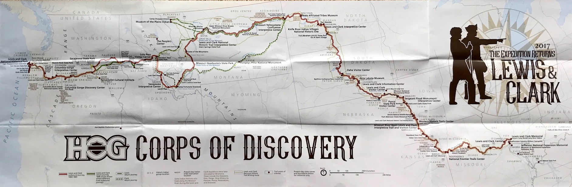
U.S. Route 50 — NV Hwy 50 — “The Loneliest Road in America”

I’m referring to U.S. Route 50, a black ribbon that stretches more than 3,000 miles across the country, from Ocean City, Maryland, to West Sacramento, California.

It’s called “The Loneliest Road in America” for a reason and when you enter Nevada at the Utah state line it travels across 500 miles of Great Basin Desert.

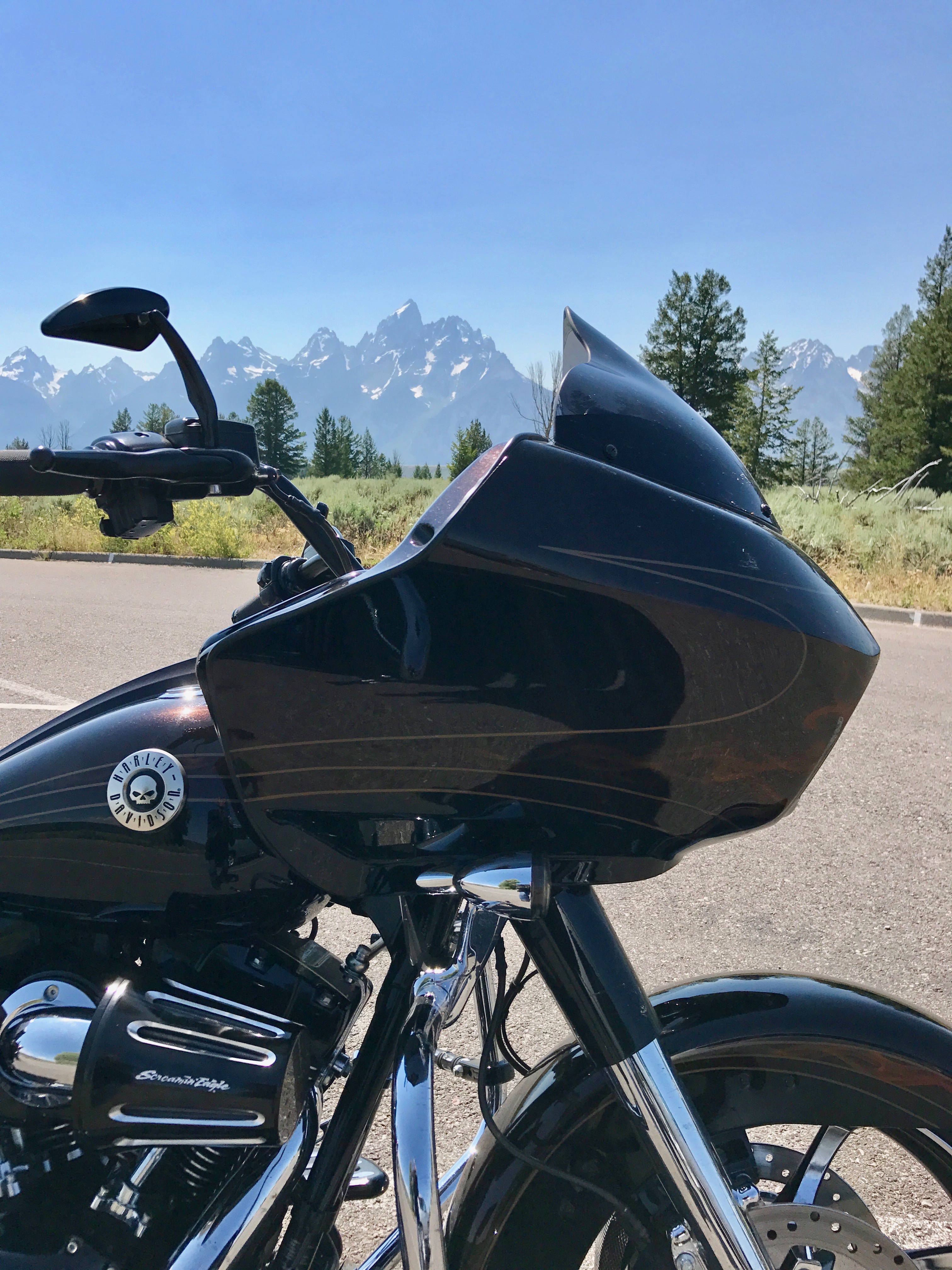
This was our early summer road trip along the historic Pony Express Trail en route to the Road Glide National Rally (aka: “Sharkweek“).

Pony Express Trail

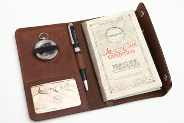
The RoadGlide.org is a community dedicated to all Harley-Davidson Road Glide owners and enthusiasts.  It’s an awesome group of people that like to discuss performance, builds, accessories, mods, specs, troubleshooting, maintenance, and much more.

The like minded gather every year in a different location to experience the roads of the local area and celebrate the ‘Glider’ camaraderie. I was granted grandfather rights to the club having previously owned a Road Glide (aka: Brownshark), but they are a most welcoming group to any rider. Besides, that tradition of featuring a bonfire of anything other than Road Glides stacked, burned and melted together amid cheering crowds is long gone!

It had been eight years since I last attended a Sharkweek event. My first was in 2013 at St. George, Utah for number III, but this was number XI and on the west coast near beautiful Lake Tahoe in Minden, Nev.  The host hotel was the Carson Valley Inn & Casino.

Hotel Nevada – Ely, NV

But, I’ve gotten ahead of myself.

We departed a day prior of the now infamous June 26th heat dome that enveloped the Pacific Northwest, driving temperatures to extreme levels — in Salem, Ore., about half-hour southwest of Portland, it reached 117 degrees.  We’re unaccustomed to that type of oppressive summer heat, but the group headed east for Boise, Idaho anyway where temperatures were a bit cooler and only slightly above 100 degrees.  We headed to The Reef for dinner where the patio is great, the food is tasty, dual bars so the lines are short and there is always a good band playing. Stop in there if you ever have an opportunity.

The next day we rode out early en route to Twin Falls and were passed by just about everyone scooting along I-84 well in excess of the posted 80 MPH speed limit except for an occasional semi. We continued south on US-93 into Nevada where the temperatures continued their relentless rise, but when we finally stopped at Hotel Nevada in Ely, Nev., we were met with cooler weather.  Go figure!

Established in 1929, the Hotel Nevada became Ely’s premiere dining and lodging destination. It is an historic property with a lot of charm down to stars in the sidewalk to celebrate those who had stayed there from Jimmy Stewart to President Lyndon Johnson. We were worn down a bit from the heat so the fact that the room was small and the bathroom even smaller didn’t matter when ready to sleep.  The lobby is a casino which other than the clouds of cigarette smoke was not a big deal and we enjoyed the free breakfast in the lobby at the Denny’s restaurant before departing on the Gold Rush–era highway that is part of the West’s last frontier.

Nevada Highway 50 — America’s Loneliest Road

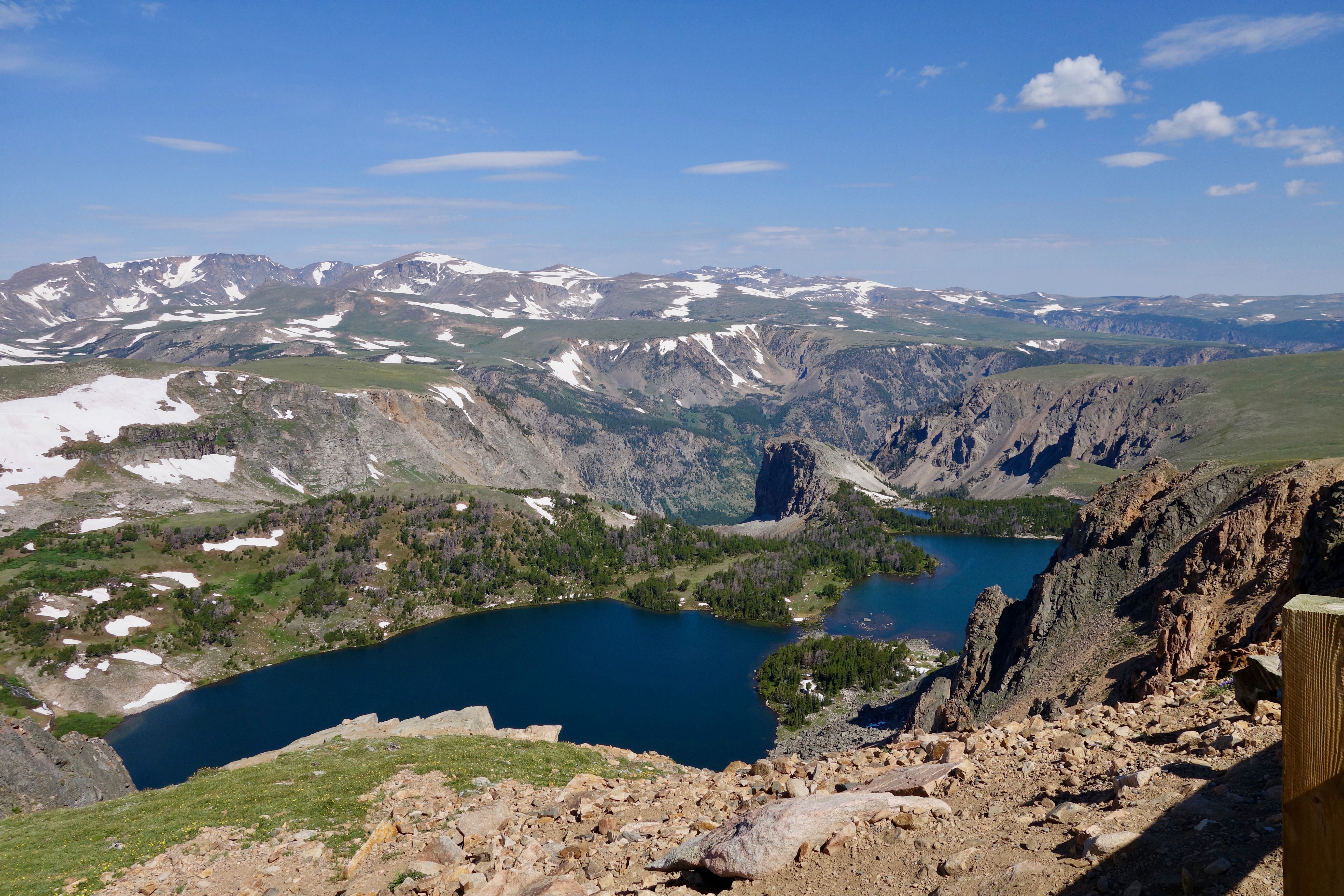
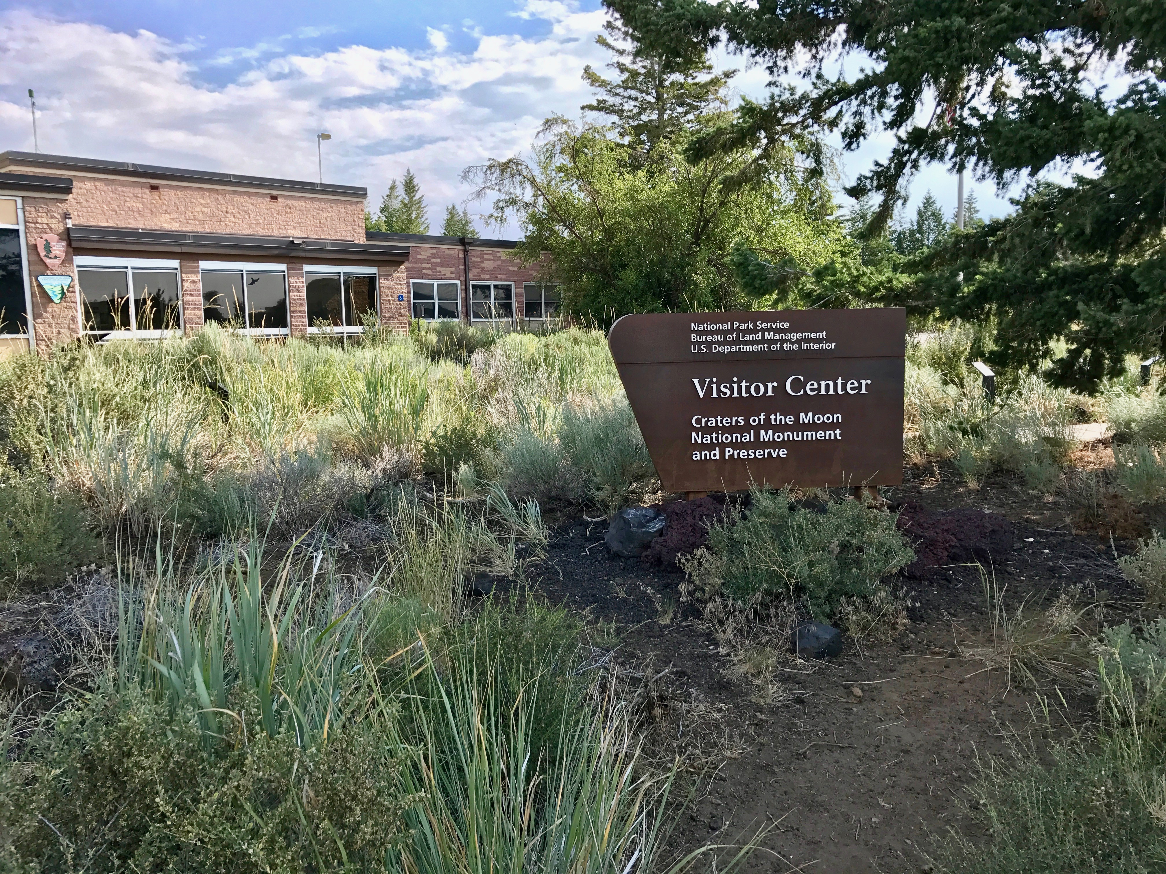
America’s Loneliest Highway — crosses by or through several communities, a handful of mountain ranges, a national park, and one reservoir, where wild horses roam free. There’s life, yes, but not something familiar for many. It’s a place where the lines between an ‘ol John Wayne Western movie and everyday life blur, and where ghost towns bleed into semi-living ones.

We had our official “survival guide” passport book and proceeded to collect stamps from the various businesses and which the governor of Nevada will supposedly sign if at least five businesses stamped our passports. The 287 mile-stretch of U.S. 50, running from Ely to Fernley, Nev., passes nine towns, two abandoned mining camps, a gas pump and the occasional coyote.

Sage Brush Ocean — Nevada Hwy 50

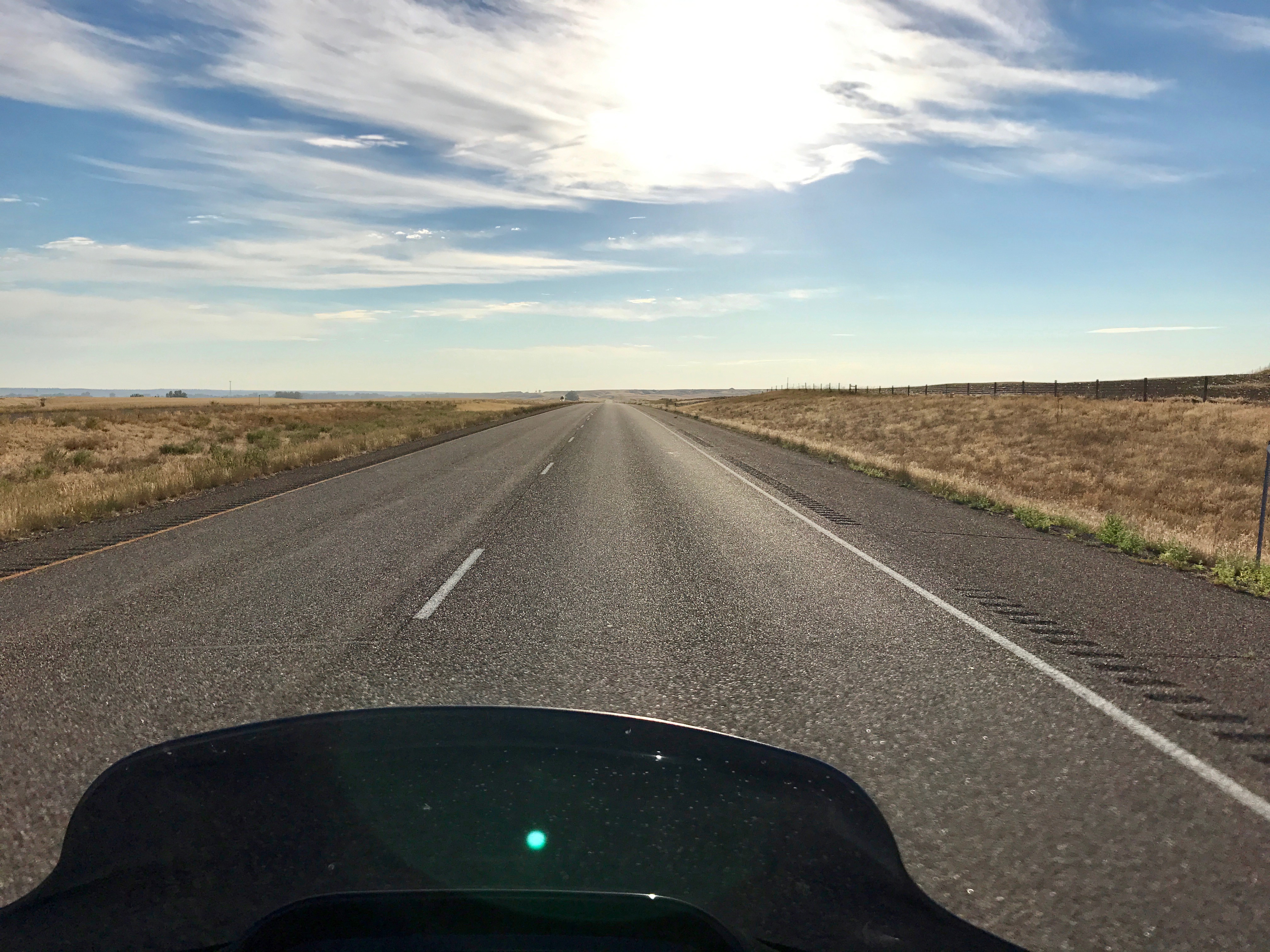
We passed a number of “Loneliest Road” signs along this black ribbon where the occasional business on the Route displayed a “I Survived Route 50” sign in a window covered with layers of dirt and grime. We rode through more than a dozen mountain ranges as we traversed the state, climbing up into the red rock heights, then dipping down into the patchy desert of the hot valley floor.

So this was it. I wondered, when first reading about Route 50, why a AAA official was so concerned about anyone traveling it and why Time Magazine wouldn’t recommend it. The journey does require a specific skill set: sitting for a very long time on a hot motorcycle saddle, knowing where the next gas station is amid the desert’s FM fuzz and more importantly, knowing how to be alone inside your head. Way inside being the operative word there in a vast “sagebrush ocean”.

The posse was adventurous, had too many Gatorade drinks and survived the Route 50 experience.  Not just tourists, but rugged participants that rode away with stamps and bragging rights of our achievement along with the real-deal memories.

We finally came to rest at base-camp in Minden, Nev., at the Carson Valley Inn & Casino and picked up our registration packet and incredibly nice bag of swag for the multi-day Road Glide National Rally (“Sharkweek XI”).

Next up is our rides in the area at Yosemite National Park via Tioga Road (Highway 120) and around Lake Tahoe before returning home through Lassen National Park.

Photos taken by the author.

All Rights Reserved © Northwest Harley Blog

Read Full Post »

Montana Border on Highway 200

Last month I posted about plans to ride through Glacier National Park.

I started making plans a couple of months prior to the ride looking for the slowest, curving roads with mountains and throwback motel stopping points to minimize pandemic exposure.

The reopening of Montana’s tourism amenities and services started in early June, which meant they were open a couple months prior to our arrival, with the exception of the Blackfeet Indian Reservation which was closed “until further notice.”  Canada also blocked all non-essential travel into the country so any mini-tour loop into BC or Alberta was off limits this trip.

It turns out that 2020 was a record-breaking year for the fact that there were NO forest fires during the days we visited the park to disrupt the spectacular views. There has been a fire in Glacier National Park almost every year of its existence with the exception of 1964 as the only year with no fires on record. Fires are a naturally recurring part of the forest lifecycle, but seeing Glacier with pristine clear air was an exceptional gift this time.

We traveled northeast crabwise across Washington state and spent a night in Sandpoint, on the northern tip of Idaho. It’s located on the magnificent 43-mile-long Lake Pend Oreille, surrounded by the Selkirk and Cabinet mountains. The next morning we traveled east on Highway 200 alongside the lake, then alongside the Clark Fork River.  We made a breakfast stop at a terrific family owned bakery in Clark Fork, called The Pantry.

Once we crossed over into Montana, we took a short detour to the remote end of Sanders County and traveled over the new $13.5 millon Heron Bridge.  It replaced a 95-year-old, one-lane bridge connecting Montana Highway 200 to the community of Heron. The original bridge had the ribbon cut on Nov. 23, 1952, but was originally fabricated in California and was already 32 years old when first installed across the river.  It had been deemed insufficient for growing traffic across the Pend Oreille River near Metaline Falls, Washington when it was moved and re-constructed at Heron.

“Sun Road” Glacier NP

After the bridge tour we rode north on Highway 56, Bull Lake Road, which is about 36 miles long and dead ends at Highway 2 just west of Libby. The landscape in the area is very diverse from low elevation timber and lakes to the outstanding peaks in the Cabinet Mountains and Scotchman Peak area.  We rode along the Kootenay River on Highway 2 to Kalispell then north on Highway 93.  We overnighted in Whitefish, MT a gateway to Glacier and a nice resort town. With a mixed array of shops, coffee houses and restaurants it reminded me of Jackson, WY charm.  There are plenty of places to enjoy a Going-to-the-Sun IPA with a great view of the mountains.

Glacier National Park, MT

The Blackfeet Indian Reservation closure created an impediment to traveling the Going-to-the-Sun road through the park and then looping back on Highway 2.

The road/gate entrance to the park was closed at St Mary. An optional route from Glacier north across the Canadian border to visit the Waterton-Glacier International Peace Park was a barrier as well since the Canadian border was closed.

At any rate, we began at West Glacier for a slow out-and-back ride on the 50-mile-long road.  There were incredible views of glacial-carved valleys, jagged peaks and pristine wilderness. A benefit of the pandemic was those famous red busses which departed from Lake McDonald Lodge were shut down and not running on the roads this year.

The Going-to-the-Sun Road was the National Park Service’s first to cross the trans-continental divide. It’s a landscape impossible to adequately describe in words or capture in photos when riding into that ‘big sky’ that Montana is famous for.

The west tunnel–a 197-foot long tunnel features two arched openings that let you look out to Heaven’s Peak and the Upper McDonald Creek valley while behind the handlebars. The Alpine section–is a six percent climb between the Loop and 6,646-foot high Logan Pass. There’s a section of the road called The Weeping Wall. A waterfall cascades 100 feet down, over the rocks and onto part of the road and down the other side of a 4500 foot cliff drop-off.

The Posse

The views! The curves! It’s like a real life painting.

For all its scenic wonders, the “Sun Road” is not without a few negatives: overall, the roads were in good shape and well-maintained, but there were a couple of rehabilitation projects and construction delays can be a major buzz-kill with all the crowds. The speed limit is slow-to-stop with much of the ride quality depending on the crowds and RVs.

The end of our round trip ride took us back into touristy West Glacier, town. Afterward we headed back to a Whitefish pub (via a motel shuttle) to try out a flight of their whiskeys and celebrate the completion of a beautiful ride.

Glacier is a place to be savored and a place to come back to again and again. It was great to get a break from the relentless protest, COVID-19 media drum beat and to reconnect with the land by motorcycle.

Photos taken by the author. 

All Rights Reserved (C) Northwest Harley Blog

Read Full Post »

Lewis and Clark; The Expedition Returned 2017

I’m a H.O.G. member, but not the type of person who displays an undying passion for the patches and pins or for that matter in attending a lot of H.O.G. events.  Sure, I’ve participated in the occasional H.O.G. rally, got the t-shirt and then headed home. Riding is primarily a solo activity for me and it’s more about riding in the wind, not the rally destination.  
 
Although there was this one time in Hawaii where it was all about the food.  The Aloha State Chapter #44 (Maui H.O.G.) were in the middle of a rally.  I wasn’t riding a motorcycle on the islands, but they were most gracious and let me enjoy some excellent pulled pork at their Luau!  We also had the opportunity to meet Cristine Sommer-Simmons, the book author of ‘Patrick Wants To Ride‘ fame.

But I’ve digressed.

Lewis and Clark Expedition Swag

A riding buddy and I decided to register and took a couple weeks last month to ride along with the H.O.G. Lewis and Clark; The Expedition Returns posse.  There were 182 register bikes for the tour which basically followed most of the same Lewis and Clark routes from Seaside, Oregon to St. Charles, Missouri.  They deviated a bit on the eastern side of the Rocky Mountains which only added to the adventure.


Before I jump in and provide some insights about the ride, I want to say that H.O.G. is a class act.  Yes, there was a pricey registration fee, but the swag and goody bag we received for the expedition was detailed, high quality and exceeded my expectations.  The hotel registration process via the H.O.G. web site worked well and we had no issues in any location.  Big shout-out to Harley-Davidson, Team MKE, Paul Raap (H.O.G. Regional Mgr), Paul Blotske (H.O.G. Contractor) and the H.O.G. planners for making it simple and a great experience!

Lewis and Clark Expedition and Routes


Now keep in mind this wasn’t a “group ride” where 182 bikes departed simultaneous every day with a ride captain.  We were free to forge our own path (with some solid guidance) and ride with who we wanted and at our own pace.  H.O.G. provided a travelogue with approximate mileage and points of interest along the way for each day’s schedule.  In some cases they included passes for the various parks and/or sight seeing destinations.  This process worked well.

Ride Details:

Day 1, (Tuesday, July 11) — Had us traveling to the Oregon coast to visit the Fort Clatsop National Historic Park  where the Corps of Discovery wintered from 1805 to Spring 1806.  After 18 months of exploring the West, the Corps of Discovery built an encampment near the mouth of the Columbia River. They wintered at Fort Clatsop into 1806 before leaving the Pacific Ocean to return to Missouri and the route we were going to follow.

That evening Mike Durbin and Paradise Harley-Davidson (Tigard, OR) sponsored the gathering for dinner.


Highway 14 looking west at Mt. Hood

Day 2, — We were traveling east and heading to Lewiston, ID.  Along the route we could visit the Rock Fort Campsite which is a natural fortification located on the shore of the Columbia River, and where the Corps of Discovery set up camp on their journey home.  There is the Columbia Gorge Interpretive Center, the Sacajawea State Park Interpretive Center, and the Lewis and Clark Trail State Park

That evening we were at Hell’s Canyon Harley-Davidson for dinner. 

 
Unsolicited Comments About Portland Traffic:  It was common practice to ask other H.O.G. members where they came from, how far they rode etc., and when we mentioned being from Portland, people were compelled to tell us about their bad experiences riding around in Portland/metro traffic.  The H.O.G. HQ hotel for this event was the Jantzen Beach Red Lion and folks would drone on about the congestion, freeway crashes and the lengthy delays which were awful in the record Portland heat.  About all I could say was “True that, and apologize for the apocalyptic congestion.”  Then I’d add something about those new spiffy ODOT RealTime signs — you know, the big electronic signs that relay the obvious?!

Day 3, — Took us to Great Falls, MT.  There were multiple stops suggested to riders.  The first was the Nez Perce National Historical Park.  The 
New Perce were critical to the success of the Expedition by providing food and supplies. 

It was hot riding so, we left Lewiston early morning and as a result the park wasn’t open and we toured the exterior.  Lewis and Clark actually split up at what is called today Travelers’ Rest State Park.  Lewis went to the north.  On the north route, you could see the Lewis and Clark Pass, Museum of the Plains Indian, and Camp Disappointment   Clark went to the south, where you could see the Lost Trail PassCamp fortunate Overlook  the three forks of the Missouri River at the Missouri Headwaters State Park, and the Gates of the Mountains.

Highway 12 heading toward Lolo Pass

We were on Highway 12 headed over Lolo Pass for much of the morning. You’ve undoubtedly seen the photos of the sign that says “Curves next 99 miles…”  Yeah, that one and it’s named one of the best motorcycle roads in the country with lots of sweeping curves and several tight ones.  The elevation at the top is 5,233 feet in the northern Rocky Mountains and the temperatures were quite nice.  Road conditions in some areas were a bit dicey and unfortunately a female member of the H.O.G. group veered up against the guardrail and crashed.  She survived with a number of broken bones, but as I understand it, spent multiple days in the hospital. As we rode by the crash, her motorcycle freakishly went 75 yards up highway 12 and across both lanes of traffic and was sitting upright on the left side of the road, as if someone just parked it there on the kick stand.  Very strange.

That evening the group all got together for dinner at Big Sky Harley-Davidson.


Day 4, — (Friday, July 14,) — Took us to Billings, MT where we spent a couple of days.  There were a couple of stops planned.  The first was t
he Lewis and Clark National Historic Trail Interpretive Center in Great Falls.  We also made sure to take time to see the Great Falls of the Missouri including Rainbow Falls before leaving the area.  

Great Falls, MT is actually situated on the northern Lewis return route, and Billings, MT is on Clark’s southern route.

Rainbow Falls

We took the more scenic route on Highway 89 south through the Helena-Lewis and Clark National Forest and then picked up Highway 12 east to Highway 3 south into Billings, MT.

That evening we had dinner at Beartooth Harley-Davidson, but to be candid we were getting a bit tired of the pork sliders or burgers and salad.


Day 5, — Was a “down day” from our ride schedule to allow riding in the Billings, MT., area.  Some jumped back on for full 400+ mile experience and rode to Livingston, MT., on I-90 then headed south on Highway 89 into Yellowstone National Park to see ‘Old Faithful.’  

Twin Lakes, along the Beartooth Highway

We decided to half that mileage and rode up Highway 212 to Red Lodge Montana and then over Beartooth Pass into Wyoming.  In Red Lodge, the annual Beartooth Rally was in full swing with a few thousand motorcyclists enjoying the area so, going over Beartooth Pass was slow riding, but we did enjoy the switchback curves.

It’s a great ride with some incredible vistas, but not for the faint of heart.

That evening we enjoyed a nice steak and ignored the gathering at Beartooth Harley-Davidson!


Day 6, — Had us traveling to Bismarck, ND., and it began early to avoid the sweltering heat. 

Across the NoDak Plains

We’d been riding in heat advisory’s across Montana for a few days and now the humidity was increasing!  One stop as we departed Billings was to tour Pompeys Pillar National Monument.  Pompeys Pillar was named by Clark and he and other members of the Corps of Discovery chiseled their names into the rock itself.  I believe this is the ONLY physical evidence that the Lewis and Clark Trail actually existed and took place. 

We rode on to Bismarck, ND.  There were additional stops along the way that included the Missouri-Yellowstone Confluence Interpretive Center and Fort Mandan.  I lived in Bismarck back in the day so, we ignored the extra miles and the point where Sacajawea and Toussaint Charbonneau joined the Corps. 

We enjoyed dinner at a local pub/restaurant while listening to some old Peter Frampton music on the jukebox! 


Fort Abraham Lincoln State Park

Day 7, — (Monday, July 17,) — The H.O.G. group headed west across the Missouri River from Bismarck and then we all rode south down Highway 1806 to Pierre, SD.  About 15 miles south of Bismarck we stopped at Fort Abraham Lincoln State Park & On-A-Slant Village and toured the area which provided a great example of Native American encampments Lewis and Clark would have encountered on their journey.

Missouri River riding south on Highway 1806

We rode along Highway 1806 south down the Missouri River pretty much to the North Dakota – South Dakota border while watching out for farm equipment on the roads.

From there, we had a couple of routes to follow into Pierre, SD., though most of the Missouri River between Bismarck and Pierre is covered by the Lake Oahe Reservoir and the road follows the east side of the lake all the way into Pierre.

Pierre, SD., City Park

We had dinner at Peterson Motors Harley-Davidson in Pierre, but actually moved over to a city park on the river and tried Bison Burgers for the first time!


Day 8, — (Tuesday, July 18,) — Due to other commitments we departed the Lewis and Clark H.O.G. group on this day and started our return trip back to Oregon.  We intended to spend a couple of days in Boise, ID., to take in the Pacific Northwest H.O.G. rally and meet up with some other riders there.  The next couple of days were about laying down some miles and we avoided the wandering of site seeing.  We rode from 
Pierre, SD to Rapid City, SD on I-90, and skirted the Black Hills National Forest.

We traveled along Highway 18 and then took a wrong turn at Lingle, SD and ended up a few miles from the  Nebraska border before having to backtrack, riding through Fort Laramie on Highway 26 and then on to I-25 and Casper, WY., where we overnighted.


Day 9, — Had us traveling to Idaho Falls, ID., and we departed early to avoid the afternoon heat.  We were riding toward the Grand Teton National Park and Jackson when about 30 miles west of Dubois, WY, we encountered a fatal head-on car accident. 

The Road Glide and Grand Teton’s

We arrived at the scene at 12:30pm and the road had been closed since 9:30am.  We had to endure a 3+ hour wait which put us behind and more importantly it put us riding in the hottest part of the day. 

The 50 miles from Jackson, WY to the border town of Alpine, WY was like walking a marathon with all the backed up traffic. 

We finally made it to Idaho Falls, ID on US26 by early evening.  

Day 10, — We continued our travel west to Boise, ID on the two-lane US 20/26.

There are views of high desert, Atomic labs and of course Craters of the Moon Monument with it’s vast ocean of lava flows and scattered islands of cinder cones and sagebrush.We stopped for some site seeing, but didn’t explore any trails.

We arrived in Boise, ID before 3pm and met up with some other riders who arrived from Portland.

Day 13, — (Sunday, July 23,) — After a couple days of enjoying the local rides and taking in the city life along with parts of the Pacific Northwest H.O.G. Rally (While at the rally in Meridian, ID., I had a chance to test ride a new 2017 CVO Street Glide with the new M-8 engine. I will do a post on that experience soon) we returned to Portland, OR via the most direct route on I-84.

We finally arrived back in Portland that evening after touring over 3,500 miles with a number of new stories from the adventure in retracing the Lewis and Clark Expedition.  In addition, we got to hang with a number of great H.O.G. members!

We could relate to Meriwether Lewis who wrote in September 1806:

Today Captain Clark will pen a letter to Governor Harrison and I shall pen one to President Jefferson informing them officially of our safe return and providing the details of our expedition. My hope, and that of Captain Clark, is that our work over the last two and a half years will accomplish this administration’s goals to expand the Republic westward and inspire future generations into even further exploration and adventure. — Meriwether Lewis 

Updated August 15, 2017:  Meriwether Lewis and William Clark left from St. Louis, Missouri with the Corps of Discovery and headed west in an effort to explore and document the new lands bought by the Louisiana Purchase.  To read more about Lewis and Clark, visit the National Geographic site dedicated to their journey or read their report of the expedition, originally published in 1814.  There are a number of period correct maps HERE.

Photos taken by author.

All Rights Reserved (C) Northwest Harley Blog

Read Full Post »

HOG Lewis And Clark Touring Rally

Lewis And Clark Touring Rally

Harley Owners Group registration is now open!

It starts on July 10th in Portland, Oregon and ends July 21st in St. Charles, Missouri.

It’s a throw back to 2002 when HOG led a contingency of riders along the route made famous by Meriwether Lewis and William Clark during their 1804 – 1806 expedition.  I didn’t attend the original ride, but wrote about it in a post HERE.  I’m sure the box of commemorative “swag” from HOG only contributed to the adventure and road stories.

From the Pacific Ocean to the banks of the Mississippi River in Missouri, the touring rally will take Harley-Davidson riders to 9 cities along the famed route, numerous museums and interpretive centers, as well as some spectacular wind in the face riding.  It’s an especially great opportunity to ride the famous Bear Tooth Pass and explore Yellowstone National Park.  Here is a post with some photos from when I traveled this route back in 2013.

It’s not an inexpensive touring rally as registration on the members.hog.com website is $450.  It does include numerous meals, commemorative merchandise and special gatherings with fellow participants as part of the event package.

Notes from the website state: Maximum Capacity for the rally is 300. Full members may invite 1 guest on the tour.  The member must register the guest under his/her member number and purchase one of the above packages.  Cancellation: Prior to May 1, 2017 there is no cancellation fee. May 2, 2017 – July 3, 2017 a 50% fee will be imposed ($225).  If the Rally Package has been mailed to members they will need to return the rally package before a refund will be issued.  Cancelation deadline is July 4th, 2017.

Alert: You might not have this issue, but I was registering for the Pacific Northwest Rally earlier in the day and had numerous issues with the HOG website hanging.  I was using a MacBook with Safari browser, but couldn’t get the site to work. I called the HOG Support phone line and it was suggested that I use Google Chrome browser, which I did and it worked fine with that browser.

Photo courtesy of HOG website.

All Rights Reserved (C) Northwest Harley Blog

Read Full Post »

I’m talking about the Timbisha Shoshone Tribe who are the native people of Death Valley.

Death Valley

Destination: Death Valley

With multiple weeks of nice weather, our posse departed Portland, Oregon early morning on September 17th with a cold front and threat of rain and the occasional spit of rain drops in the face. We haplessly listened to the V-Twin’s drone on as we traveled east on Interstate 84 for 426 miles.

Long delay due to overturned semi on I-84

Long delay caused by an overturned Concrete semi on I-84

We arrived in Boise late afternoon which was hosting Oktoberfest in the Basque Block part of the vibrant downtown!  We enjoyed some island fare and refreshments on the rooftop tiki patio at The Reef.  Crowds gathered in the closed off streets for authentic German biers, food and of course the occasional chicken dance.  And in what has to be one of the best Idaho cover bands — Pilot Error — rocked the crowd most of the evening.  Here is a video of the band doing a Def Leppard cover with Derek Roy as lead vocal and the awesome Roger Witt – on lead guitar.

As the evening wore on it seemed filled with young college kids who were trying hard to “be” the club scene.  Like those videos produced by I’m Shmacked.

Idaho Basin

Snake River and Great Basin area

The next morning was a continuation east on the mind-numbing straight road of Interstate 84. However, we really clicked off the miles to Twin Falls doing the freeway speed limit which is now set at 80 mph!  We rolled along and were surprised by how many 18-wheelers tried to pass us.

As a side bar, you might recall that in the mid-1970s, Congress established a national maximum speed limit by withholding highway funds from states that maintained speed limits greater than 55 mph. Do you remember the “I can’t drive 55” days?  The requirement was loosened for rural interstates in 1987 and completely repealed in 1995. As of today, 41 states have speed limits of 70 mph or higher. Oregon state legislators who seem to know more than the average citizen about how to protect us from ourselves just recently increased some rural interstate speeds to 70 mph.  Texas is the fastest at 85 mph.

Idaho

In route to Ely, NV

But I’ve digressed.  This part of our arid motorcycle journey took us on the Thousand Springs Scenic Byway which runs through the Snake River Canyon. We rode through bright green irrigated fields, crossed the Snake River, saw a waterfall spilling from the top of a high bluff, and watched windmills turning in the stiff wind.  As we headed further south on U.S. Route 93 we split the Great Basin that covers most of Nevada and part of Utah. There were mountains to the East and West, and the traffic thinned to an occasional tractor-trailer hauling freight or cattle.

Our ride ended that day in Ely, Nevada, which was founded as a stagecoach stop along the Pony Express, and later became a booming copper mining town.

We parked the bikes and enjoyed a nice dinner at the La Fiesta Mexican Restaurant.

On the Lonliest Road

On Nevada’s Loneliest Road

The following day we were up early and continued our ride south on one of Nevada’s loneliest roads.  I’m not sure about you, but I find the Nevada desert to be immensely beautiful and awe-inspiring. Even though most of the roads are flat and straight, the scenery is grand and I always enjoy the ride.

Just a few miles south of Ely is a turnoff for the Ward Charcoal ovens.  We didn’t travel down the eight miles of gravel road, but there are beehive-shaped stone kilns built by Mormons around 1876 to produce fuel for the silver and lead smelters serving the mines on Ward Mountain.  As you look across the valley at the Big Basin National Park, there is the 13,000 foot Wheeler Peak standing off in the distant.

More Lonely Road...

More Lonely Road…

We traveled the mostly straight 240+ miles and finally rolled into North Las Vegas and could see the skyline of the famous Las Vegas strip.  Speaking of the city that never sleeps, our posse picked up a lot of traffic at the U.S. 93/I-15 interchange and were immediately greeted with a dude on a sport bike weaving in and out of lanes.  Then adding to the traffic drama he started to split lanes at full on freeway speeds.

I must have missed that part of the training about how motorcyclists should always make sudden moves in heavy traffic!  Most people who’ve had any experience driving in and around Vegas know that it can be a bit treacherous. Cages with locals that always seem to be in a hurry and cabbies are out in force all day and night driving fast and cutting across multiple lanes.  Add to that the tourists trying to navigate a new city on the freeways and it’s a perfect storm of distracted drivers.

After all the traffic hustle and bustle I was looking forward to parking the bike for awhile and relaxing around the pool for a day.  That evening we took on the “clickers” (i.e. porn panderers) who stand on every corner of the Strip and aggressively try to shove advertisements for adult entertainment in your face.

Selfie

Departing Las Vegas

Don’t take me wrong, Las Vegas has world-class restaurants, cool bars, amazing entertainment and great weather, but after a couple of days of breathing air freshener the casinos pump into their ventilation systems to mask the reeking of camels, cigarillos, cigars and those slot machines going ding-ding-ding… I’m ready for some fresh air and wind in the face!

We did have an opportunity to walk through the sprawling Harley-Davidson dealer across from the “Welcome to Las Vegas” sign.  We checked out the new Milwaukee Eight touring bikes and spent some time chatting with a knowledgeable sales person about the 2017 differences.


It wasn’t too long (about 48 hours) and Las Vegas was in our mirrors as we rode out into the desert on Hwy 160.  We departed the city early so that we could tour through Death Valley before it got too hot.  It was still in the high-70 degree range as we departed.  We increased altitude going through Red Rock Canyon National Park toward Pahrump as the desert landscape morphs from sandy, rocky terrain dotted with low brush and creosote bushes.  Big stratified rock formations and hills define the valleys in the distance, closing in on the road periodically before opening up to a wide expanse of flat desert floor. It’s a wonderland of muted color.
Rearward pic

Looking back on Hwy 190

We fueled up in Pahrump which is an interesting town.  Like in the rest of Nevada, gambling is legal in Pahrump, and there are several casinos to take advantage of that fact. But, unlike Las Vegas, the casinos in Pahrump are present but not dominant. They’re smaller and a little less intimidating.  There might be some wisdom in staying overnight in Pahrump instead of the hectic scene in Vegas. Certainly the traffic situation would be a lot less stressful.

At the Death Valley junction we turned west on Hwy 190 and headed for Furnace Creek where the Native American tribe known as the Death Valley Timbisha Shoshone Band of California are located.

Initially it was was quite comfortable, but as we descended into the valley it felt like someone was turning up an oven.  It was still early and the temps were in the high 80’s but by the time we stopped in Furnace Creek it was 100 degrees.  Surprisingly hot for the end of September, but the scenery is spectacular!

Death Valley

Death Valley – Timbisha Shoshone Tribe

It’s some of the best “landscape” on the planet that looks a bit like you’ve arrived on Mars. There’s nothing growing out there higher than your knee yet it will be forever etched in your memory as not just one of the greatest motorcycle rides ever but one of the most beautiful.  At one place in the park you can look down at one of the lowest points on earth at -280 feet in one direction and up to the highest point in the continental U.S. in another (Mt. Whitney, at 14,494).  It’s an amazing color contrast.

Existing Death Valley

Exiting Death Valley

We scurried on out of the national park and headed toward Mammoth Lakes on Hwy 395.  The first real town you come to is Lone Pine. In the early to mid 20th century, the area around Lone Pine, particularly the Alabama Hills, which lie between the highway and the Sierra range, was a popular setting for western movies.  Just west of town you’ll get another nice view of Mt. Whitney.

By the time we rode through the Inyo National Forest the desert heat had faded and we were getting hit with cooler air.  Much, much cooler as we gained altitude and it started to spit rain drops.  Not enough to soak the road or require rain gear, but enough to make it a bit uncomfortable.  Our ride on this day ended at Mammoth Lakes which is a ski and outdoor-sports town.

Heading up toward Mammoth Lakes

Heading up toward Mammoth Lakes

Surprisingly it rained most of the night, but the sky cleared up in the early morning and we departed Mammoth Lakes with the temperature only in the high 40’s.  A brisk start to our riding day as we continued north on Hwy 395 on the eastern side of the Sierra’s.  We rode around Mono Lake, and we climbed to another 8100-foot ridge, which offers a great view back to the Mono basin before starting back down past the turn-off for Bodie.

Mono Lake

Mono Lake

The last real town before your reach Nevada is Bridgeport.  We stopped at the Bridgeport Inn, for breakfast.  A nice place built in 1877 and about 23 miles from Mono Lake.  It’s a family run historic period Victorian hotel, old Irish pub, and fine dining restaurant.  After warming up a bit we continue our ride and crossed into Nevada about 50 miles after Bridgeport. Aptly named Topaz Lake covers the state line next to the highway as you cross.

We arrived in Reno for the start of Street Vibrations 2016. Downtown was rumbling with motorcycles of all shapes and sizes for the fall rally which marks the last big motorcycle rally of the season for the west. There was no shortage of vendors and having been to the event a number of times we repeated some of the events over a couple of days.

The Posse

The Destination: Timbisha Indian Country Posse

Part of the posse departed early Saturday morning and some headed out late morning to return back to Portland.  I’m not sure about you, but I don’t take many photos on the return trip from Reno as I’ve been on these roads a lot over the years and just focused on riding home vs. scenery.


In summary, we traveled over 2100 miles in 8 days with no mishaps, tickets or mechanical malfunctions. What more can you ask for?


Street Vibrations UPDATE:  There was some disappointing  news surrounding Street Vibrations which I learned of upon my return.  Jeffrey Sterling Duke, 57, of Georgetown, Calif. was shot to death on Interstate 80 near Truckee on Saturday night.  According to law enforcement he was semi-associated with the Vagos Motorcycle Club and his Facebook page noted that he was a Green Nation Supporter.

According to officials three motorcyclists rode up to the victim and fired multiple gunshots before taking off.  It’s not clear if this shooting is associated, but you might recall that five years ago this past weekend, members of the Vagos and Hells Angels Motorcycle Clubs exchanged gunfire during a deadly brawl on the floor of a casino in Sparks.

Randy Burke (Road Shows) applies some media “spin” and explains why the Street Vibrations Rally is not to be blamed for the shooting.

Photos taken by author.

All Rights Reserved (C) Northwest Harley Blog

Read Full Post »

Screen Shot 2015-04-07 at 9.10.26 AMThe Pacific Northwest…bounded on one side by the pacific ocean and the other side is the mountainous Rocky’s.

It’s perfect for finding a two-lane crowd-free by-way and rolling past acres of lush forest.  Those acres can turn into meandering hours of riding the countryside on a motorcycle.   In fact, the Pacific Northwest HOG rally will be hosted in the picture-esq Northwest (Portland) in a couple of weeks where we will deliver the aesthetic vision of why we ride!

Welcoming the 1000’s of riders to the adventure will be hot and dry weather.  Not only will they encounter the best weather temps, but they will also have to deal with wildfires.  Yes, the west could be described as being on fire!

Wildfires In Oregon and Washington State

Wildfires In Oregon and Washington State

The fires across the region have forced evacuation, burned down structures and created breathing issues for some.  Twenty minutes outside the Portland metro area the air is thick with particulate and smoke permeates the sky for miles across the region.  In Washington state over a 1000 people have been evacuated in Chelan county.  The Warm Springs fire (Countyline 2 fire) in Oregon has exploded into the largest fire at 36K acres.  U.S. 26 is closed at Oregon 126.

According to NatGeo, on average more than 100K wildfires clear 4-5 million acres each year in the U.S.  In 2014, some 1.2 million acres burned in Oregon and Washington and sadly this year it’s looking like a repeat.

Wildfires In Canada, BC

Wildfires In Canada, BC

In scanning the reports I got to thinking about the last time I’ve taken a motorcycle trip during the summer that wasn’t marred with a wildfire.  Of course it depends on how many miles I’ve traveled, but in a typical week long ride during the summer I realized that it’s been a fair number of years where I didn’t pass near or through a burning wildfire during a ride.  I’ve had multiple trips to Sturgis.  Through Yellowstone Park, through Glacier National Park – both with fires on multiple trips.  There was U.S. Route 550 or the “million dollar highway” that had a San Jan National Forest fire.  There was Beartooth Highway (U.S. Hwy 212) and a lingering wildfire.  I’ve taken a couple extended trips up north to British Columbia Canada and the land of lumberjacks was on fire both times.  In most all cases we were not close enough to see flames, but dark smoke and particles filled the sky for many miles as we navigated across the country.

In Washington and Oregon there are now 31 major wildfires currently burning.  See the map.  In Canada BC, there are even more.

In addition to the economic woes that these fires cause it does makes one wonder whether motorcyclists should even consider traveling the west during the height of the summer fire season.

But, life is for living and I’m not talking about the thrill of a car ride snaking through the marquee Going-to-the-Sun-Road in Glacier.  It’s about feeling small in a very big world and how that is a great thing on a motorcycle.  So, I’ll continue to plan motorcycle trips to ride the west – wildfires and all!  Sure some of my photos will be filled with smoke obscuring the mountain views but, just know that I’ll have a big smile underneath that slightly wetted down dew rag covering my face!

Photos courtesy of the Oregonian and NWCC.

All Rights Reserved © Northwest Harley Blog

Read Full Post »

The new Harley-Davidson™ Riding Academy

The new Harley-Davidson™ Riding Academy logo

Back in April, Harley-Davidson unveiled its new Riding Academy in the U.S., which is a program to help students take their first lessons in riding and they get to do it on a Harley-Davidson Street 500 motorcycle.

You might recall that the Harley-Davidson™  Riding Academy was previously called Rider’s Edge®.  In September 2012 the program celebrated a milestone of training 300,000 riders since starting in 2000.  At the time the Buell Blast, a motorcycle made by the Buell Motorcycle Company was used in the Rider’s Edge New Rider program.  In July 2009, prior to ceasing all motorcycle production, Buell ran an ad campaign stating that the Buell Blast would no longer appear in their line-up and the ad featured a Buell Blast being destroyed in an automobile crusher.

The new Harley-Davidson™ Riding Academy is a national rider training program and is likely to be hosted by Harley-Davidson dealerships across the country.

The old Rider's Edge® logo

The old Rider’s Edge® logo

It’s designed to get folks comfortable on a bike and give them the skills needed to ride with confidence.  The students are trained on the motorcycle that they will be riding and will also be taught the basics of rider safety. All the student needs to bring is the riding gear that consists of a long sleeves, jeans/pants, ankle length footwear, full gloves, eyewear and DOT standard helmet. The academy will provide a motorcycle and certified instructors from Motorcycle Safety Foundation (MSF). The course features a minimum of 20 hours of classroom and range training with two instructors guiding 12 students at a time. The practice range is where students learn maneuvers such as turning, braking, going over obstacles and controlling skids.

Some thought the original Rider’s Edge Program was a pricey version of the MSF Basic Rider Course with four additional promotional/marketing hours added into the curriculum. Otherwise the curriculum of the two were nearly identical.  I have not been through the new Riding Academy, but would anticipate that it’s a Harley-Davidson branded version of the new 2014 MSF curriculum.

The motorcycle used in the new Harley-Davidson Riding Academy is the newly launched liquid-cooled Harley-Davidson Street 500.  I suspect the strategy of incorporating the Street 500 motorcycle is that students will want to keep riding after the class is over once they’ve learned on the motorcycle… maybe even consider a purchase.  The Street 500 is fitted with a vehicle protection kit that protects the motorcycle in case a student is not able to maintain balance and topples it. In addition, there is a first of its kind Power Limit Calibration system that is in place to restrict the bikes at low gear speeds allowing only the maximum speed needed for the course.  Or put another way, it modifies the fuel injection system and de-powers the bike.  If you’re looking for initial impressions of the bike for training check out this post HERE.

Once the training has been completed, the students will get an MSF Basic Rider Course completion card which may even exempt students from the state testing for a motorcycle endorsement, but this varies state to state. Harley states that this card may even help new riders in getting a discount on their motorcycle insurance.

TEAM OREGON Locations

TEAM OREGON Training Locations

But, what about the state of Oregon?

It looks like the Oregon Harley-Davidson dealers get somewhat of a pass on managing the new Riding Academy logistics since the only approved training is provided by TEAM OREGON.

If you’ve been riding awhile you’ll recall that Oregon was the first state to break away from MSF and Idaho soon followed.  There is 40-years of history, but in 2003, the last time MSF released a new curriculum, TEAM OREGON decided the new product didn’t meet the riders of Oregon needs.  However, MSF would not support continued use of the old product so, TEAM OREGON designed their own curriculum to meet the needs of Oregon riders.  The prevailing viewpoint was the California-based MSF “one-size-fits-all curriculum” didn’t address local issues – for example, Florida’s riding environment is much different from Washington State’s, which is unlike Wisconsin’s or New York’s.  MSF sued TEAM OREGON in 2006 over the curriculum they developed which the Oregon Department of Justice and Oregon State University tenaciously defended and in December 2008 the MSF agreed to abandon its lawsuit without any monetary settlement.  More details on the lawsuit are located HERE.

Independent of where you live in the Northwest, this blog has promoted safe motorcycle operation and suggested many times that riders be life-long learners.  Take a training class.

More information can be found at: TEAM OREGON – Basic (BRT) and Intermediate (IRT) courses are available statewide and meet Oregon’s mandatory training requirement.  Idaho STAR Motorcycle Safety Program;  Advanced Street SkillsPuget Sound Safety

Photos courtesy H-D and TEAM OREGON.  Shout-out to Pat Hahn (TEAM OREGON Communications and Outreach Manager) who was consulted for accuracy in the writing of this article.

All Rights Reserved © Northwest Harley Blog

Read Full Post »

PacificNW-RallyEach week motorcycle rally’s seem to rise as the temperatures and if you attend one the smiles are contagious!

I wanted to bring your attention to the first ever tri-state H.O.G. rally which occurs July 24-27th in Spokane Valley, Washington.

No doubt you’ve seen on TV documentaries, rumor or cameo showcases in the media where a rally is deemed a magical place.  It’s hard not to notice the spectacle of all things chrome and leather symbolizing the culture of Harley-Davidson.  Motorcycle rally’s are an American icon and you can’t mistake the looks, the sound and the feel of a H.O.G rally!

Some of you will undoubtedly try and tell me that there is no new blood coming to the H.O.G. rally’s.  That they’ve become nothing more than the equivalent of a state fair.  Conventional, cliche, and common.  And then I always seem to get an email or two reciting the Sturgis Rally statistic… the average age of a Sturgis attendee is about 52 and the only young people there are usually brought in as staff.  So, take your eyes off of the bartender from Raleigh trying to earn college tuition for the year with the pronounced cleavage and take notice of all the AARP people behind her.

My advice is if you don’t have fun at rallies then, give up!  Don’t go because whining is so 1999.

Like many of you, however, I enjoy motorcycle rallies.  It’s that simple.  The people, the energy, the passion, the spirit, the vendors and, of course, the motorcycles. It’s a great opportunity to have real conversations with other enthusiasts.  And, I’m a sucker for information, for your story.  I want to hear everybody’s story.

It’s tough to narrow down a list of things that I like about a motorcycle rally, but after the most important—wind in the face journey—here are a few:

People Watching—The cast of characters you see at motorcycle rallies are unlike people you’ll see at any other type of event, bar none. And the funny thing about it is this – they’re not just hardcore bikers.  I’ve seen kids to grandparents, from plumbers and bus drivers to attorneys and Wall Street traders. From long hair and long beards to clean cut and clean shaven. From party-crazed to people that could be your next door neighbors.

What’s New—Rally’s are the place to find some of the newest bike products and gear. This is where manufacturers and distributors launch new merchandise, show off their stuff and try to start a buzz with their best customers.  In addition you’re likely to get wind of a special place to take your bike for a “once-in-a-lifetime” journey, whether it’s a major ride or a side trip. And you’ll know it’s worth experiencing the ride for yourself because the people at rallies live for this stuff.

Showcase—Motorcycle rally’s are the ultimate place to showoff your bike. This is why many of us spend every free hour riding, cleaning, fine tuning or just staring at our motorcycle. Whether you ride the newest model or decades-old legend, rallies are where like-minded folks can talk about their rides and showoff the latest accessories.

Downtime Fun On The Road—Concerts featuring rock and country bands that I care about. Regional food and refreshments from the best local hangouts. Bike shows and parades. Biker gear and apparel from national and independent brands.

Passion—Riders who show up at a motorcycle rally are passionate about their bikes.  It’s easy to sit down and talk for hours, sharing stories about the sights you’ve seen, the terrain you’ve covered, and the roads you’ve traveled.

What’s your favorite part of a motorcycle rally?

See you in Spokane Valley!

Photo courtesy of H.O.G.

All Rights Reserved © Northwest Harley Blog

Read Full Post »

Expedition Supply Kit

Expedition Supply Kit

It’s throwback Thursday…

And nearly twelve years ago motorcyclists retraced the Lewis and Clark trail.

It was the summer of 2002 and in August about 500 Harley-Davidson riders completed a 2-week journey from St. Charles, Missouri to Seaside, OR while re-tracing the path of the historic Lewis and Clark Expedition.

The ride was hosted by HOG and on this trip it included events dealing with Lewis and Clark history as well as they handed out medallions along the way, echoing the gesture of the “peace medals” distributed by Lewis and Clark and their Corps of Discovery on the original expedition.

Travelogue Notepad

Travelogue Notepad

HOG provided riders an “Expedition Supply Kit,” a package of “swag” which included a canteen, a leather wallet and a travelogue notepad.  Riders visited sites in Kansas City, MO; Sioux City, Iowa; Pierre, SD; Bismarck, ND; Billings, MT and Lewiston, Idaho.

At the time, the Associated Press interviewed riders and reported, “…on a motorcycle you don’t just see it, you smell and feel it.”

I couldn’t agree more.  There is no substitute for seeing the countryside on a motorcycle.

Anyone out there participate on this ride?

Photo courtesy of H-D and HOG.

All Rights Reserved © Northwest Harley Blog

Read Full Post »

4-Corners By Harley-Davidson – Part 3

Beartooth Pass Scenic Highway

Gaining Altitude on Beartooth Pass Scenic Highway

This is a continuation of Part-2 HERE, of our 4000-mile journey to 4-Corners that led us through Oregon, Idaho, Utah, New Mexico, Arizona, Colorado, Nebraska, Wyoming, South Dakota/Sturgis, Montana, Northern Idaho, Washington and then back to Oregon.

Billings to Bear Tooth Pass – Yellowstone – Bozeman, MT – On this morning we said “Hasta la vista, baby” to one of the riders in our group who had to peel off and take a more direct route home to Oregon.

Beartooth Pass

On Beartooth Pass

The rest of the posse was heading to Wyoming’s highest paved primary road…the Beartooth Scenic Byway.

It’s on Highway 212 and runs about 70 miles south and then west from Red Lodge in Wyoming to Cooke City, in Montana. The online data states that the Beartooth Pass summit is at 10,947 feet although our GPS from the top was reading 10,957 feet.

Beartooth Pass

Riding Across The Top Of Beartooth Pass

It didn’t matter because it felt like we were on the top of the world and could see 100’s of miles!

It is an incredible road to ride a motorcycle on and although I’ve never been there, I believe it would compete with riding through the Swiss Alps for excitement.   The road is essentially in two parts – the lower section that rises as you head south out of Red Lodge and the upper part at the higher elevations.

Descending Beartooth Pass

Descending Beartooth Pass

The views on the way up are terrific and it is a difficult decision whether to continue riding or stop every ¼ mile and take pictures.  We did some of both, including GoPro’s mounted on the helmets to video record parts of the trip.  We met other riders along the road and they all had big smiles on their faces as if we had all found a long lost secret riding location.

Some parts of the upper section of Beartooth Pass had gusty winds that were inconsistent from bend-to-bend that required our attention and it was much colder at the higher altitude.  Nothing more than leather jackets, and the slopes were steep and the views were spectacular.  On top there was snow in the shadow parts of the mountain.

Northeast entrance to Yellowstone National Park

Northeast entrance to Yellowstone National Park

We made several photo stops on the way down as we headed toward the Northeast Entrance of Yellowstone Park.

In the summer this is a dramatic entrance with a rich diversity of landscape compared to other entrances to the park.  Traffic was very light and just after we entered the park at 7,365-feet altitude, we cut between the 10,928-foot Abiathar Peak and the 10,404-foot Barronette Peak.

Bison in Lamar Valley

Bison in Lamar Valley

Lamar Valley is home to large amounts of Bison, some of which we met on the road meandering along without a care in the world.  We exited the park at Gardiner where The Roosevelt Arch is located.  The top of the Roosevelt Arch is inscribed with “For the benefit and enjoyment of the people,” which is from the Organic Act of 1872, the enabling legislation for Yellowstone National Park.

The Roosevelt Arch

The Roosevelt Arch – Yellowstone National Park

We continued on to Bozeman, MT., and overnighted at the rather nice Best Western Plus Grantree Inn.  There was an upscale sports bar and restaurant in the hotel and we grab dinner there and chatted with some of the locals.

Bozeman to Shelby, MT – The next morning we fueled up early and motored north on US Route 86.  It’s also referred to as the Bridger Range Scenic Drive.

On US Route 86 - Bridger Range Scenic Drive

On US Route 86 – Bridger Range Scenic Drive

It’s about 40miles and intersects with Highway 89 north of the town of Wilsall.  The road follows the eastern flank of the Bridger Mountains.  Once the road enters the National Forest, the views are a bit more limited due to the thick forest, but there are still enough open areas to keep the drive interesting.  The Bridger Bowl ski resort is about 20min from Bozeman.

Smith Valley

Smith River Valley

There are no services along the route, but what an incredible scenic road!  If you ever get a chance ride this route do it.  The road is a nicely paved and provides excellent views of the mountains which dominated the view to the west.

We connected up with US Route 89 which is the “Backbone of the Rockies” and links seven National Parks across the Mountain West.  We rode through the The Smith River Valley.  Stopped for a late breakfast at the Branding Iron Café in White Sulphur Springs.

IMG_3393ADeparting White Sulphur Springs meant we were on the Kings Hill Scenic Byway as it winds through the Little Belt Mountains.  We passed through the Lewis and Clark National Forest and savored the rugged beauty.

As the scenery turn flat there were gravel roads that crisscrossed US Route 89 all the way to Great Falls.  It was hot with a lot of wind buffeting on this day and in Great Falls we stopped at Big Sky Harley-Davidson for a soda break and to look for a t-shirt.

Glacier National Park - Going The Sun Road

Glacier National Park – Going To The Sun Road

We departed and connected with I-15 north and headed toward Shelby.  Several miles up I-15 we stopped at the Mountain View Co-Op in Brady for fuel.  We ran into some old farmers there and spend a good deal of time chatting about various items from how loud the bikes were to the price of wheat.  It was almost like a TV show!

We arrived in Shelby and overnighted at the Comfort Inn.  It was an interesting hotel with part of it being on Indian reservation and had gambling in the lobby, but the rooms in the new section had just opened and they had friendly service.  We walked down the hill and ate dinner at the Ringside Ribs which was full of hungry truck drivers.

Riding the Going To The Sun Road - Glacier National Park

Riding the Going To The Sun Road – Glacier National Park

Shelby to Sandpoint, ID (via Going To The Sun Road and West Glacier) – We departed fairly early the next day and motored out on Highway 2 west bound.  We were headed for the “Going To The Sun Road” at St. Mary and east entrance of Glacier National Park.  We rode through Cut Bank then Browning and when refueling in St. Mary we took some time for refreshments.

If you’ve never driven a motorcycle on the Going-to-the-Sun Road it’s clearly one of the top 10 national park experiences.

Going To The Sun Road

Riding the Going To The Sun Road

There is significantly less traffic (shuttle buses and tourists) when traversing the park east to west and we didn’t have to contend with large crowds at any of the prime viewing pullouts.  The road offers a visual assortment of moutain views that anyone will enjoy.  It’s narrow in places, and in a constant state of repair due to the annual freeze-thaw cycle.

We didn’t pull off at the Logan Pass visitor center.

Lake

Lake McDonald

We’ve been down this road before and the visitor center crowds are not our gig.  The view of the Clements Mountain and the southern tip of the Garden Wall were terrific.  Many of the park visitors motor up the pass aboard a Red Jammer, one of Glacier’s renowned fire engine-red, open-air touring buses that debuted in 1937.  Supposedly they gained their nickname for the way drivers “jammed” their way through the gears.

"Glides" on the Going To The Sun Road

“Glides” on the Going To The Sun Road

We had GoPro camera’s running through much of our way down to West Glacier where it looks like time has stood still in this remote corner of Montana.  The log buildings have changed very little since they were built in 1938.  Any “inappropriate development” has been curtailed and the village has maintain its historic character.  There was a quick break at the village and we were making good time so we continued on to Kalispell.  We motored on and thought about stopping in Libby, but continued on to Bonners Ferry then connected with Highway 95 south for Sandpoint, ID.

Bonner's Ferry, ID

Bonner’s Ferry, ID

We had left the plains-induced sweat running down our backs for cooler temperatures and it was nice riding.  Although I have to admit that the cumulative riding over the previous 11 days had started to wear on me.   We were heading toward home at this point so the time to pull off and take photos were few.  We were really about getting through some miles.

It had been a 345 mile day through some slow going,  RV and tourist ridden roads, but we were in Sandpoint and checked into the La Quinta Inn before 6pm.

Sandpoint, ID at the La Quinta Inn

Sandpoint, ID at the La Quinta Inn

We showered and had refreshments at Connie’s.  We intended to eat at a Thai restaurant, but ran out of patience and instead had dinner at Connie’s.

Sandpoint to Portland – The next morning we were again up and on the road before 7:30am because we had a 430+ mile day and the forecast was searing heat.  We headed out of town and caught a glimpse of the city’s new downtown by-pass as we headed across the Sandpoint Long Bridge.  It was slow going on Highway 95 to Coeur d’Alene, but we pick up speed once we connected with I-90 and then Highway 395 through the Washington State farm land.  We pulled into the Country Travel Plaza for a fuel and refreshment stop as the heat of the day wore on.  We had a late lunch at C&D Drive In at Boardman and then rolled into Portland around 5pm.

After 400-miles the sun sets on the "Glide"

The sun sets on the end of the 4-Corners “Glide” adventure

It’s not often that you get to ride for the pure enjoyment of the open road and the excitement of what’s around the next curve.

We were on the road for 12-days, visited eleven states, made new friends, discovered a part of history and rumbled across 4000 miles of the U.S.  There were smells, wind gusts, moisture hungry lowland desert, tall pines and scented blooms along with blazing sun, searing heat, rugged landscape and mountain peaks that reached up and touched the clouds.  It was a most rewarding trip and riding the adventure with some classy motorcycle buddies was priceless!

That was the 4-Corner’s ride in August 2012.  It is now history forever saved on the internet!

This is multi-part blog post.  Part 1 – HERE and Part 2 – HERE.

Photos by author.

All Rights Reserved © Northwest Harley Blog

Read Full Post »

Older Posts »