Feeds:
Posts
Comments

Posts Tagged ‘Montana’

Montana Border on Highway 200

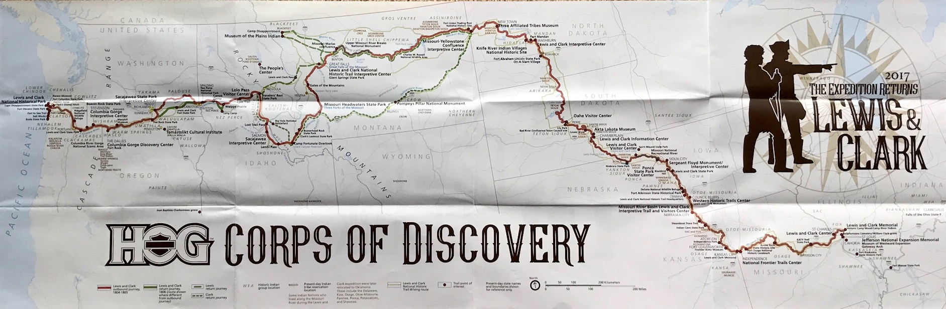
Last month I posted about plans to ride through Glacier National Park.

I started making plans a couple of months prior to the ride looking for the slowest, curving roads with mountains and throwback motel stopping points to minimize pandemic exposure.

The reopening of Montana’s tourism amenities and services started in early June, which meant they were open a couple months prior to our arrival, with the exception of the Blackfeet Indian Reservation which was closed “until further notice.”  Canada also blocked all non-essential travel into the country so any mini-tour loop into BC or Alberta was off limits this trip.

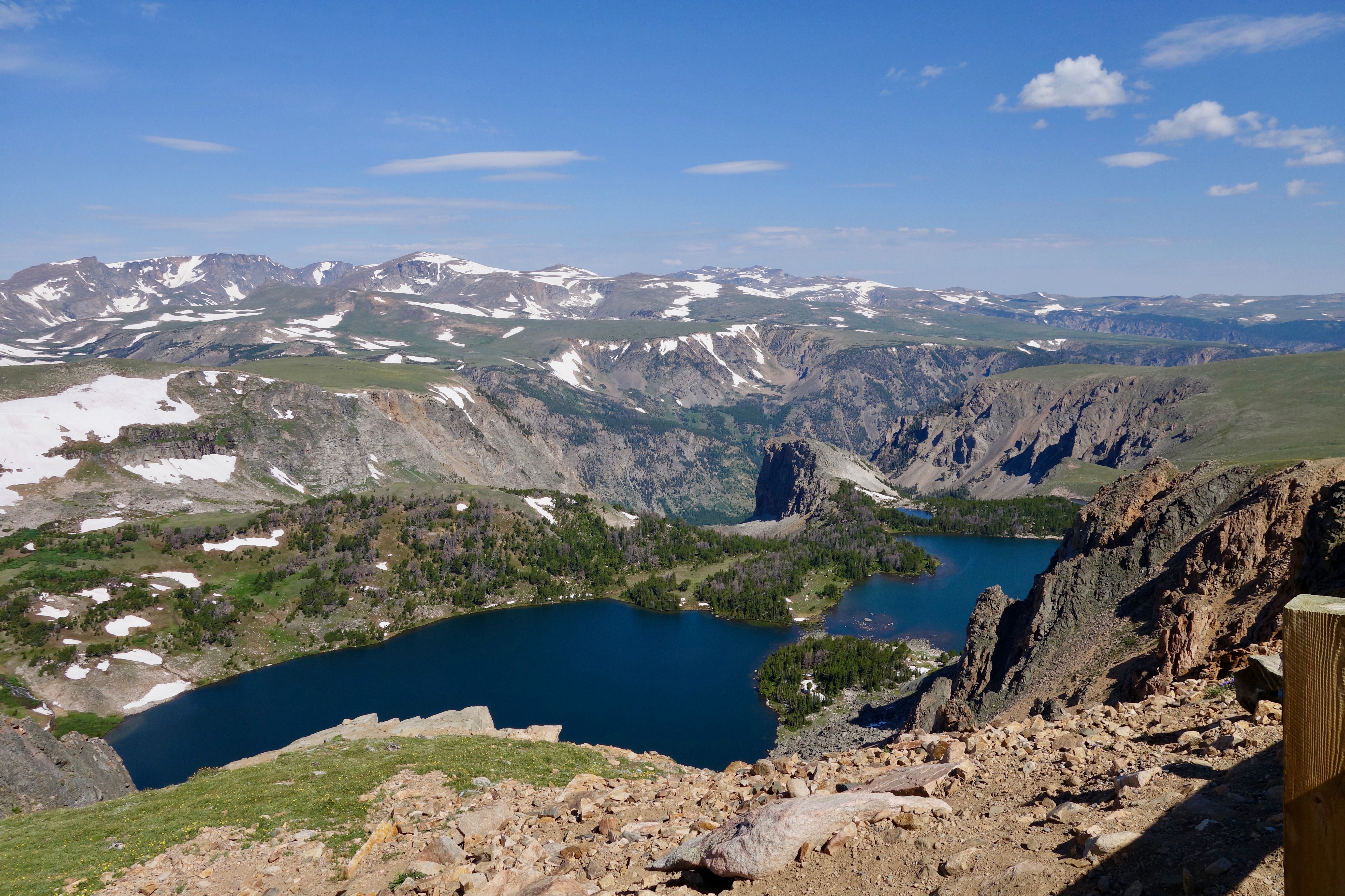
It turns out that 2020 was a record-breaking year for the fact that there were NO forest fires during the days we visited the park to disrupt the spectacular views. There has been a fire in Glacier National Park almost every year of its existence with the exception of 1964 as the only year with no fires on record. Fires are a naturally recurring part of the forest lifecycle, but seeing Glacier with pristine clear air was an exceptional gift this time.

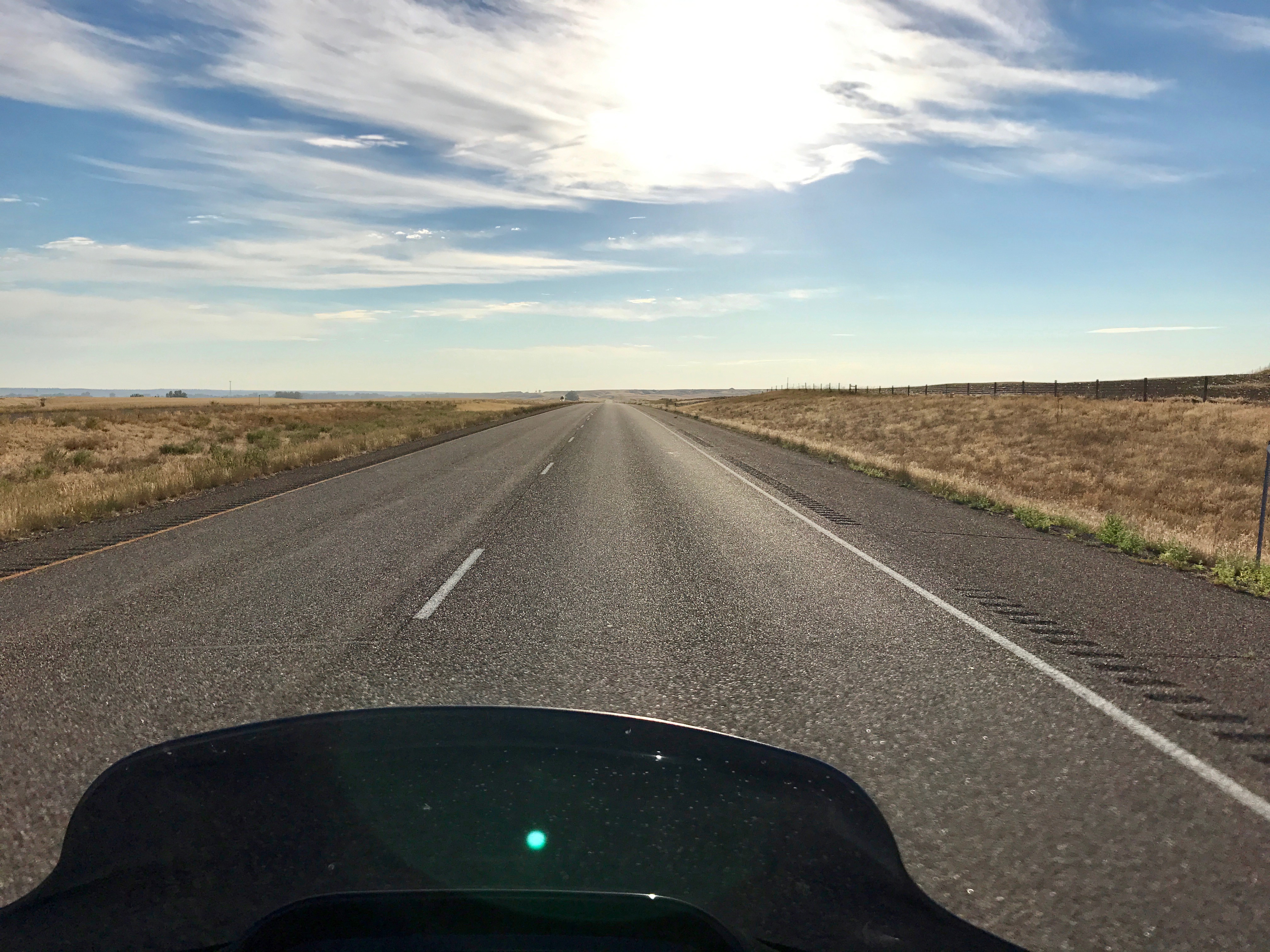
We traveled northeast crabwise across Washington state and spent a night in Sandpoint, on the northern tip of Idaho. It’s located on the magnificent 43-mile-long Lake Pend Oreille, surrounded by the Selkirk and Cabinet mountains. The next morning we traveled east on Highway 200 alongside the lake, then alongside the Clark Fork River.  We made a breakfast stop at a terrific family owned bakery in Clark Fork, called The Pantry.

Once we crossed over into Montana, we took a short detour to the remote end of Sanders County and traveled over the new $13.5 millon Heron Bridge.  It replaced a 95-year-old, one-lane bridge connecting Montana Highway 200 to the community of Heron. The original bridge had the ribbon cut on Nov. 23, 1952, but was originally fabricated in California and was already 32 years old when first installed across the river.  It had been deemed insufficient for growing traffic across the Pend Oreille River near Metaline Falls, Washington when it was moved and re-constructed at Heron.

“Sun Road” Glacier NP

After the bridge tour we rode north on Highway 56, Bull Lake Road, which is about 36 miles long and dead ends at Highway 2 just west of Libby. The landscape in the area is very diverse from low elevation timber and lakes to the outstanding peaks in the Cabinet Mountains and Scotchman Peak area.  We rode along the Kootenay River on Highway 2 to Kalispell then north on Highway 93.  We overnighted in Whitefish, MT a gateway to Glacier and a nice resort town. With a mixed array of shops, coffee houses and restaurants it reminded me of Jackson, WY charm.  There are plenty of places to enjoy a Going-to-the-Sun IPA with a great view of the mountains.

Glacier National Park, MT

The Blackfeet Indian Reservation closure created an impediment to traveling the Going-to-the-Sun road through the park and then looping back on Highway 2.

The road/gate entrance to the park was closed at St Mary. An optional route from Glacier north across the Canadian border to visit the Waterton-Glacier International Peace Park was a barrier as well since the Canadian border was closed.

At any rate, we began at West Glacier for a slow out-and-back ride on the 50-mile-long road.  There were incredible views of glacial-carved valleys, jagged peaks and pristine wilderness. A benefit of the pandemic was those famous red busses which departed from Lake McDonald Lodge were shut down and not running on the roads this year.

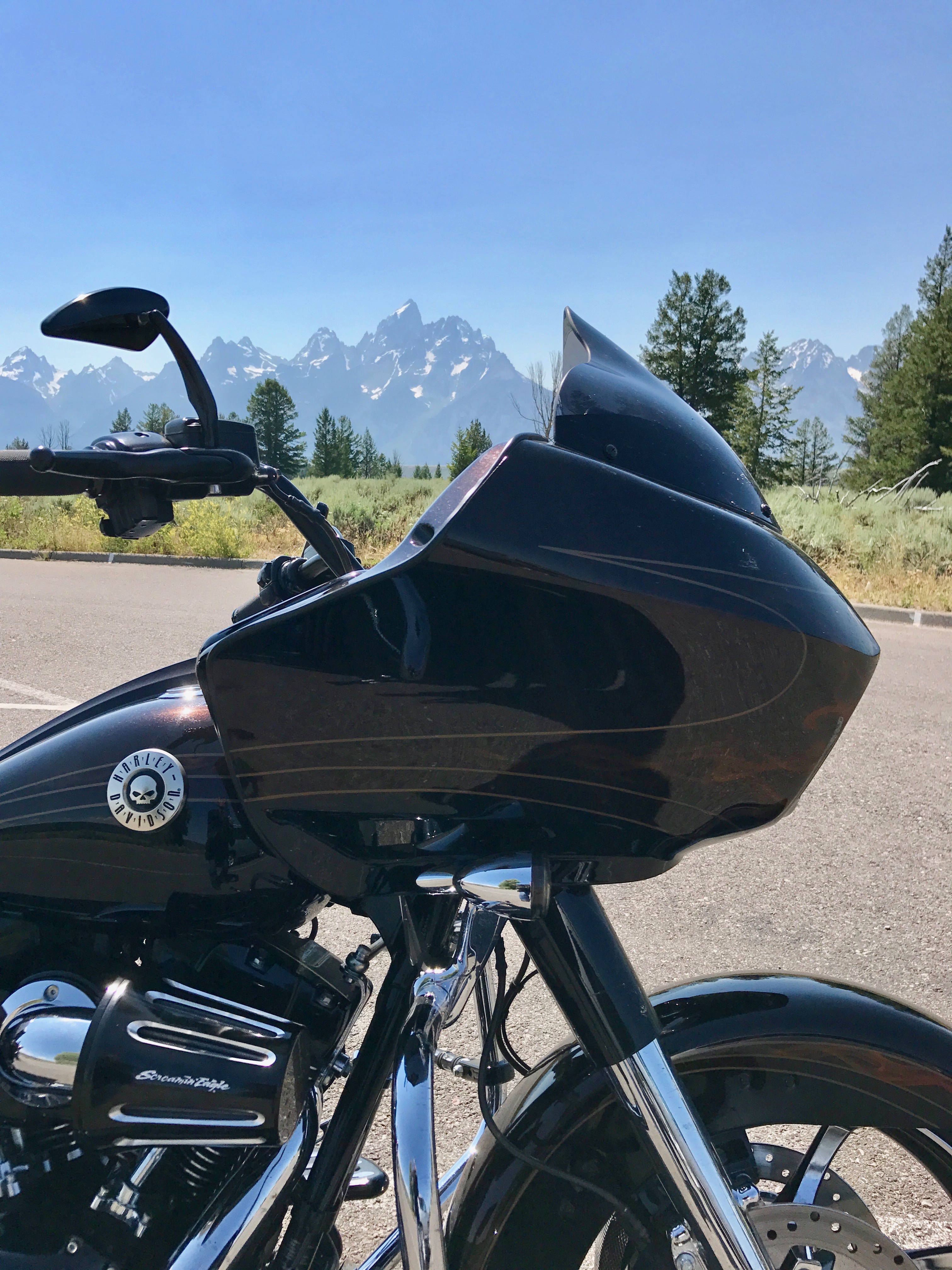
The Going-to-the-Sun Road was the National Park Service’s first to cross the trans-continental divide. It’s a landscape impossible to adequately describe in words or capture in photos when riding into that ‘big sky’ that Montana is famous for.

The west tunnel–a 197-foot long tunnel features two arched openings that let you look out to Heaven’s Peak and the Upper McDonald Creek valley while behind the handlebars. The Alpine section–is a six percent climb between the Loop and 6,646-foot high Logan Pass. There’s a section of the road called The Weeping Wall. A waterfall cascades 100 feet down, over the rocks and onto part of the road and down the other side of a 4500 foot cliff drop-off.

The Posse

The views! The curves! It’s like a real life painting.

For all its scenic wonders, the “Sun Road” is not without a few negatives: overall, the roads were in good shape and well-maintained, but there were a couple of rehabilitation projects and construction delays can be a major buzz-kill with all the crowds. The speed limit is slow-to-stop with much of the ride quality depending on the crowds and RVs.

The end of our round trip ride took us back into touristy West Glacier, town. Afterward we headed back to a Whitefish pub (via a motel shuttle) to try out a flight of their whiskeys and celebrate the completion of a beautiful ride.

Glacier is a place to be savored and a place to come back to again and again. It was great to get a break from the relentless protest, COVID-19 media drum beat and to reconnect with the land by motorcycle.

Photos taken by the author. 

All Rights Reserved (C) Northwest Harley Blog

Read Full Post »

Riding the Going To The Sun Road – Glacier National Park

From Acadia to Zion our country’s most spectacular landscape treasures are protected inside the parks.

No map or brochure can prepare you for that first motorcycle ride and peering out over a guardrail at snowy mountain peaks, waterfalls that flow down the valley through the forests, and end in a clear blue lake carved out by glaciers. The mountain mornings always have a bite of cold as the sun takes its time to wake, while meandering through the incredible scenery.

I’m talking about National Parks in general and specifically Glacier National Park, Montana which in my view shines above the rest.

Glacier National Park – Going The Sun Road

It never gets old and I plan to ride through the million-acre paradise later this month and take a COVID-19 mental diversion through the park. Montana has plenty of mountain roads where motorcyclists can ride and absorb the landscape, but the crown jewel is the Going-to-the-Sun Road. It crosses the Continental Divide carves through the steep grade of rock and forest with roughly 50 miles of sweeping curves and hairpin switchbacks along with an occasional tunnel passage through the mountain.

The national parks are such a gift, one we’ve given to each other. One we’ve inherited and, with luck, will pass down to the generations that follow us.

Speaking of paying it forward…

Going To The Sun Road

The National Park System comprises 419 national park sites, but only 62 of them have the “National Park” designation in their names. The other sites fall into different National Park System categories like National Historic Sites, National Monuments, National Seashores, National Recreation Areas, and others.

You might be surprised to learn that the National Park Service accounts for 84 million acres of land at more than 400 different sites, but as of 2019, they were due for $11.9 billion (that’s a B!) in deferred maintenance and repairs. Fortunately, the current administration recently signed a bipartisan bill (Great American Outdoors Act) that will pay for repairs at national parks, permanently finance the Land and Water Conservation Fund (LWCF) and in addition will create a lot of jobs.  The bill directs up to $6.65 billion to priority fixes and up to $3 billion for agencies such as the Fish and Wildlife Service. In addition, the bill will allocate $900 million each year to the conservation fund. The program – which has existed for half a century – has historically been plagued by funding shortfalls.

Lake McDonald

The Great American Outdoors Act enacted last week is clearly the most consequential funding for national parks, wildlife refuges, and public recreation facilities in U.S. history since the conservation legacy of President Theodore Roosevelt in the early 1900s.

As motorcycle enthusiasts, we can take heart that there’s always going to be those historic chalets, lodges, and miles of tarmac with beautiful landscapes that meander their way through the firs, aspen, and stone.

Photos taken by author.

All Rights Reserved (C) Northwest Harley Blog

Read Full Post »

Lewis and Clark; The Expedition Returned 2017

I’m a H.O.G. member, but not the type of person who displays an undying passion for the patches and pins or for that matter in attending a lot of H.O.G. events.  Sure, I’ve participated in the occasional H.O.G. rally, got the t-shirt and then headed home. Riding is primarily a solo activity for me and it’s more about riding in the wind, not the rally destination.  
 
Although there was this one time in Hawaii where it was all about the food.  The Aloha State Chapter #44 (Maui H.O.G.) were in the middle of a rally.  I wasn’t riding a motorcycle on the islands, but they were most gracious and let me enjoy some excellent pulled pork at their Luau!  We also had the opportunity to meet Cristine Sommer-Simmons, the book author of ‘Patrick Wants To Ride‘ fame.

But I’ve digressed.

Lewis and Clark Expedition Swag

A riding buddy and I decided to register and took a couple weeks last month to ride along with the H.O.G. Lewis and Clark; The Expedition Returns posse.  There were 182 register bikes for the tour which basically followed most of the same Lewis and Clark routes from Seaside, Oregon to St. Charles, Missouri.  They deviated a bit on the eastern side of the Rocky Mountains which only added to the adventure.


Before I jump in and provide some insights about the ride, I want to say that H.O.G. is a class act.  Yes, there was a pricey registration fee, but the swag and goody bag we received for the expedition was detailed, high quality and exceeded my expectations.  The hotel registration process via the H.O.G. web site worked well and we had no issues in any location.  Big shout-out to Harley-Davidson, Team MKE, Paul Raap (H.O.G. Regional Mgr), Paul Blotske (H.O.G. Contractor) and the H.O.G. planners for making it simple and a great experience!

Lewis and Clark Expedition and Routes


Now keep in mind this wasn’t a “group ride” where 182 bikes departed simultaneous every day with a ride captain.  We were free to forge our own path (with some solid guidance) and ride with who we wanted and at our own pace.  H.O.G. provided a travelogue with approximate mileage and points of interest along the way for each day’s schedule.  In some cases they included passes for the various parks and/or sight seeing destinations.  This process worked well.

Ride Details:

Day 1, (Tuesday, July 11) — Had us traveling to the Oregon coast to visit the Fort Clatsop National Historic Park  where the Corps of Discovery wintered from 1805 to Spring 1806.  After 18 months of exploring the West, the Corps of Discovery built an encampment near the mouth of the Columbia River. They wintered at Fort Clatsop into 1806 before leaving the Pacific Ocean to return to Missouri and the route we were going to follow.

That evening Mike Durbin and Paradise Harley-Davidson (Tigard, OR) sponsored the gathering for dinner.


Highway 14 looking west at Mt. Hood

Day 2, — We were traveling east and heading to Lewiston, ID.  Along the route we could visit the Rock Fort Campsite which is a natural fortification located on the shore of the Columbia River, and where the Corps of Discovery set up camp on their journey home.  There is the Columbia Gorge Interpretive Center, the Sacajawea State Park Interpretive Center, and the Lewis and Clark Trail State Park

That evening we were at Hell’s Canyon Harley-Davidson for dinner. 

 
Unsolicited Comments About Portland Traffic:  It was common practice to ask other H.O.G. members where they came from, how far they rode etc., and when we mentioned being from Portland, people were compelled to tell us about their bad experiences riding around in Portland/metro traffic.  The H.O.G. HQ hotel for this event was the Jantzen Beach Red Lion and folks would drone on about the congestion, freeway crashes and the lengthy delays which were awful in the record Portland heat.  About all I could say was “True that, and apologize for the apocalyptic congestion.”  Then I’d add something about those new spiffy ODOT RealTime signs — you know, the big electronic signs that relay the obvious?!

Day 3, — Took us to Great Falls, MT.  There were multiple stops suggested to riders.  The first was the Nez Perce National Historical Park.  The 
New Perce were critical to the success of the Expedition by providing food and supplies. 

It was hot riding so, we left Lewiston early morning and as a result the park wasn’t open and we toured the exterior.  Lewis and Clark actually split up at what is called today Travelers’ Rest State Park.  Lewis went to the north.  On the north route, you could see the Lewis and Clark Pass, Museum of the Plains Indian, and Camp Disappointment   Clark went to the south, where you could see the Lost Trail PassCamp fortunate Overlook  the three forks of the Missouri River at the Missouri Headwaters State Park, and the Gates of the Mountains.

Highway 12 heading toward Lolo Pass

We were on Highway 12 headed over Lolo Pass for much of the morning. You’ve undoubtedly seen the photos of the sign that says “Curves next 99 miles…”  Yeah, that one and it’s named one of the best motorcycle roads in the country with lots of sweeping curves and several tight ones.  The elevation at the top is 5,233 feet in the northern Rocky Mountains and the temperatures were quite nice.  Road conditions in some areas were a bit dicey and unfortunately a female member of the H.O.G. group veered up against the guardrail and crashed.  She survived with a number of broken bones, but as I understand it, spent multiple days in the hospital. As we rode by the crash, her motorcycle freakishly went 75 yards up highway 12 and across both lanes of traffic and was sitting upright on the left side of the road, as if someone just parked it there on the kick stand.  Very strange.

That evening the group all got together for dinner at Big Sky Harley-Davidson.


Day 4, — (Friday, July 14,) — Took us to Billings, MT where we spent a couple of days.  There were a couple of stops planned.  The first was t
he Lewis and Clark National Historic Trail Interpretive Center in Great Falls.  We also made sure to take time to see the Great Falls of the Missouri including Rainbow Falls before leaving the area.  

Great Falls, MT is actually situated on the northern Lewis return route, and Billings, MT is on Clark’s southern route.

Rainbow Falls

We took the more scenic route on Highway 89 south through the Helena-Lewis and Clark National Forest and then picked up Highway 12 east to Highway 3 south into Billings, MT.

That evening we had dinner at Beartooth Harley-Davidson, but to be candid we were getting a bit tired of the pork sliders or burgers and salad.


Day 5, — Was a “down day” from our ride schedule to allow riding in the Billings, MT., area.  Some jumped back on for full 400+ mile experience and rode to Livingston, MT., on I-90 then headed south on Highway 89 into Yellowstone National Park to see ‘Old Faithful.’  

Twin Lakes, along the Beartooth Highway

We decided to half that mileage and rode up Highway 212 to Red Lodge Montana and then over Beartooth Pass into Wyoming.  In Red Lodge, the annual Beartooth Rally was in full swing with a few thousand motorcyclists enjoying the area so, going over Beartooth Pass was slow riding, but we did enjoy the switchback curves.

It’s a great ride with some incredible vistas, but not for the faint of heart.

That evening we enjoyed a nice steak and ignored the gathering at Beartooth Harley-Davidson!


Day 6, — Had us traveling to Bismarck, ND., and it began early to avoid the sweltering heat. 

Across the NoDak Plains

We’d been riding in heat advisory’s across Montana for a few days and now the humidity was increasing!  One stop as we departed Billings was to tour Pompeys Pillar National Monument.  Pompeys Pillar was named by Clark and he and other members of the Corps of Discovery chiseled their names into the rock itself.  I believe this is the ONLY physical evidence that the Lewis and Clark Trail actually existed and took place. 

We rode on to Bismarck, ND.  There were additional stops along the way that included the Missouri-Yellowstone Confluence Interpretive Center and Fort Mandan.  I lived in Bismarck back in the day so, we ignored the extra miles and the point where Sacajawea and Toussaint Charbonneau joined the Corps. 

We enjoyed dinner at a local pub/restaurant while listening to some old Peter Frampton music on the jukebox! 


Fort Abraham Lincoln State Park

Day 7, — (Monday, July 17,) — The H.O.G. group headed west across the Missouri River from Bismarck and then we all rode south down Highway 1806 to Pierre, SD.  About 15 miles south of Bismarck we stopped at Fort Abraham Lincoln State Park & On-A-Slant Village and toured the area which provided a great example of Native American encampments Lewis and Clark would have encountered on their journey.

Missouri River riding south on Highway 1806

We rode along Highway 1806 south down the Missouri River pretty much to the North Dakota – South Dakota border while watching out for farm equipment on the roads.

From there, we had a couple of routes to follow into Pierre, SD., though most of the Missouri River between Bismarck and Pierre is covered by the Lake Oahe Reservoir and the road follows the east side of the lake all the way into Pierre.

Pierre, SD., City Park

We had dinner at Peterson Motors Harley-Davidson in Pierre, but actually moved over to a city park on the river and tried Bison Burgers for the first time!


Day 8, — (Tuesday, July 18,) — Due to other commitments we departed the Lewis and Clark H.O.G. group on this day and started our return trip back to Oregon.  We intended to spend a couple of days in Boise, ID., to take in the Pacific Northwest H.O.G. rally and meet up with some other riders there.  The next couple of days were about laying down some miles and we avoided the wandering of site seeing.  We rode from 
Pierre, SD to Rapid City, SD on I-90, and skirted the Black Hills National Forest.

We traveled along Highway 18 and then took a wrong turn at Lingle, SD and ended up a few miles from the  Nebraska border before having to backtrack, riding through Fort Laramie on Highway 26 and then on to I-25 and Casper, WY., where we overnighted.


Day 9, — Had us traveling to Idaho Falls, ID., and we departed early to avoid the afternoon heat.  We were riding toward the Grand Teton National Park and Jackson when about 30 miles west of Dubois, WY, we encountered a fatal head-on car accident. 

The Road Glide and Grand Teton’s

We arrived at the scene at 12:30pm and the road had been closed since 9:30am.  We had to endure a 3+ hour wait which put us behind and more importantly it put us riding in the hottest part of the day. 

The 50 miles from Jackson, WY to the border town of Alpine, WY was like walking a marathon with all the backed up traffic. 

We finally made it to Idaho Falls, ID on US26 by early evening.  

Day 10, — We continued our travel west to Boise, ID on the two-lane US 20/26.

There are views of high desert, Atomic labs and of course Craters of the Moon Monument with it’s vast ocean of lava flows and scattered islands of cinder cones and sagebrush.We stopped for some site seeing, but didn’t explore any trails.

We arrived in Boise, ID before 3pm and met up with some other riders who arrived from Portland.

Day 13, — (Sunday, July 23,) — After a couple days of enjoying the local rides and taking in the city life along with parts of the Pacific Northwest H.O.G. Rally (While at the rally in Meridian, ID., I had a chance to test ride a new 2017 CVO Street Glide with the new M-8 engine. I will do a post on that experience soon) we returned to Portland, OR via the most direct route on I-84.

We finally arrived back in Portland that evening after touring over 3,500 miles with a number of new stories from the adventure in retracing the Lewis and Clark Expedition.  In addition, we got to hang with a number of great H.O.G. members!

We could relate to Meriwether Lewis who wrote in September 1806:

Today Captain Clark will pen a letter to Governor Harrison and I shall pen one to President Jefferson informing them officially of our safe return and providing the details of our expedition. My hope, and that of Captain Clark, is that our work over the last two and a half years will accomplish this administration’s goals to expand the Republic westward and inspire future generations into even further exploration and adventure. — Meriwether Lewis 

Updated August 15, 2017:  Meriwether Lewis and William Clark left from St. Louis, Missouri with the Corps of Discovery and headed west in an effort to explore and document the new lands bought by the Louisiana Purchase.  To read more about Lewis and Clark, visit the National Geographic site dedicated to their journey or read their report of the expedition, originally published in 1814.  There are a number of period correct maps HERE.

Photos taken by author.

All Rights Reserved (C) Northwest Harley Blog

Read Full Post »

4-Corners By Harley-Davidson – Part 3

Beartooth Pass Scenic Highway

Gaining Altitude on Beartooth Pass Scenic Highway

This is a continuation of Part-2 HERE, of our 4000-mile journey to 4-Corners that led us through Oregon, Idaho, Utah, New Mexico, Arizona, Colorado, Nebraska, Wyoming, South Dakota/Sturgis, Montana, Northern Idaho, Washington and then back to Oregon.

Billings to Bear Tooth Pass – Yellowstone – Bozeman, MT – On this morning we said “Hasta la vista, baby” to one of the riders in our group who had to peel off and take a more direct route home to Oregon.

Beartooth Pass

On Beartooth Pass

The rest of the posse was heading to Wyoming’s highest paved primary road…the Beartooth Scenic Byway.

It’s on Highway 212 and runs about 70 miles south and then west from Red Lodge in Wyoming to Cooke City, in Montana. The online data states that the Beartooth Pass summit is at 10,947 feet although our GPS from the top was reading 10,957 feet.

Beartooth Pass

Riding Across The Top Of Beartooth Pass

It didn’t matter because it felt like we were on the top of the world and could see 100’s of miles!

It is an incredible road to ride a motorcycle on and although I’ve never been there, I believe it would compete with riding through the Swiss Alps for excitement.   The road is essentially in two parts – the lower section that rises as you head south out of Red Lodge and the upper part at the higher elevations.

Descending Beartooth Pass

Descending Beartooth Pass

The views on the way up are terrific and it is a difficult decision whether to continue riding or stop every ¼ mile and take pictures.  We did some of both, including GoPro’s mounted on the helmets to video record parts of the trip.  We met other riders along the road and they all had big smiles on their faces as if we had all found a long lost secret riding location.

Some parts of the upper section of Beartooth Pass had gusty winds that were inconsistent from bend-to-bend that required our attention and it was much colder at the higher altitude.  Nothing more than leather jackets, and the slopes were steep and the views were spectacular.  On top there was snow in the shadow parts of the mountain.

Northeast entrance to Yellowstone National Park

Northeast entrance to Yellowstone National Park

We made several photo stops on the way down as we headed toward the Northeast Entrance of Yellowstone Park.

In the summer this is a dramatic entrance with a rich diversity of landscape compared to other entrances to the park.  Traffic was very light and just after we entered the park at 7,365-feet altitude, we cut between the 10,928-foot Abiathar Peak and the 10,404-foot Barronette Peak.

Bison in Lamar Valley

Bison in Lamar Valley

Lamar Valley is home to large amounts of Bison, some of which we met on the road meandering along without a care in the world.  We exited the park at Gardiner where The Roosevelt Arch is located.  The top of the Roosevelt Arch is inscribed with “For the benefit and enjoyment of the people,” which is from the Organic Act of 1872, the enabling legislation for Yellowstone National Park.

The Roosevelt Arch

The Roosevelt Arch – Yellowstone National Park

We continued on to Bozeman, MT., and overnighted at the rather nice Best Western Plus Grantree Inn.  There was an upscale sports bar and restaurant in the hotel and we grab dinner there and chatted with some of the locals.

Bozeman to Shelby, MT – The next morning we fueled up early and motored north on US Route 86.  It’s also referred to as the Bridger Range Scenic Drive.

On US Route 86 - Bridger Range Scenic Drive

On US Route 86 – Bridger Range Scenic Drive

It’s about 40miles and intersects with Highway 89 north of the town of Wilsall.  The road follows the eastern flank of the Bridger Mountains.  Once the road enters the National Forest, the views are a bit more limited due to the thick forest, but there are still enough open areas to keep the drive interesting.  The Bridger Bowl ski resort is about 20min from Bozeman.

Smith Valley

Smith River Valley

There are no services along the route, but what an incredible scenic road!  If you ever get a chance ride this route do it.  The road is a nicely paved and provides excellent views of the mountains which dominated the view to the west.

We connected up with US Route 89 which is the “Backbone of the Rockies” and links seven National Parks across the Mountain West.  We rode through the The Smith River Valley.  Stopped for a late breakfast at the Branding Iron Café in White Sulphur Springs.

IMG_3393ADeparting White Sulphur Springs meant we were on the Kings Hill Scenic Byway as it winds through the Little Belt Mountains.  We passed through the Lewis and Clark National Forest and savored the rugged beauty.

As the scenery turn flat there were gravel roads that crisscrossed US Route 89 all the way to Great Falls.  It was hot with a lot of wind buffeting on this day and in Great Falls we stopped at Big Sky Harley-Davidson for a soda break and to look for a t-shirt.

Glacier National Park - Going The Sun Road

Glacier National Park – Going To The Sun Road

We departed and connected with I-15 north and headed toward Shelby.  Several miles up I-15 we stopped at the Mountain View Co-Op in Brady for fuel.  We ran into some old farmers there and spend a good deal of time chatting about various items from how loud the bikes were to the price of wheat.  It was almost like a TV show!

We arrived in Shelby and overnighted at the Comfort Inn.  It was an interesting hotel with part of it being on Indian reservation and had gambling in the lobby, but the rooms in the new section had just opened and they had friendly service.  We walked down the hill and ate dinner at the Ringside Ribs which was full of hungry truck drivers.

Riding the Going To The Sun Road - Glacier National Park

Riding the Going To The Sun Road – Glacier National Park

Shelby to Sandpoint, ID (via Going To The Sun Road and West Glacier) – We departed fairly early the next day and motored out on Highway 2 west bound.  We were headed for the “Going To The Sun Road” at St. Mary and east entrance of Glacier National Park.  We rode through Cut Bank then Browning and when refueling in St. Mary we took some time for refreshments.

If you’ve never driven a motorcycle on the Going-to-the-Sun Road it’s clearly one of the top 10 national park experiences.

Going To The Sun Road

Riding the Going To The Sun Road

There is significantly less traffic (shuttle buses and tourists) when traversing the park east to west and we didn’t have to contend with large crowds at any of the prime viewing pullouts.  The road offers a visual assortment of moutain views that anyone will enjoy.  It’s narrow in places, and in a constant state of repair due to the annual freeze-thaw cycle.

We didn’t pull off at the Logan Pass visitor center.

Lake

Lake McDonald

We’ve been down this road before and the visitor center crowds are not our gig.  The view of the Clements Mountain and the southern tip of the Garden Wall were terrific.  Many of the park visitors motor up the pass aboard a Red Jammer, one of Glacier’s renowned fire engine-red, open-air touring buses that debuted in 1937.  Supposedly they gained their nickname for the way drivers “jammed” their way through the gears.

"Glides" on the Going To The Sun Road

“Glides” on the Going To The Sun Road

We had GoPro camera’s running through much of our way down to West Glacier where it looks like time has stood still in this remote corner of Montana.  The log buildings have changed very little since they were built in 1938.  Any “inappropriate development” has been curtailed and the village has maintain its historic character.  There was a quick break at the village and we were making good time so we continued on to Kalispell.  We motored on and thought about stopping in Libby, but continued on to Bonners Ferry then connected with Highway 95 south for Sandpoint, ID.

Bonner's Ferry, ID

Bonner’s Ferry, ID

We had left the plains-induced sweat running down our backs for cooler temperatures and it was nice riding.  Although I have to admit that the cumulative riding over the previous 11 days had started to wear on me.   We were heading toward home at this point so the time to pull off and take photos were few.  We were really about getting through some miles.

It had been a 345 mile day through some slow going,  RV and tourist ridden roads, but we were in Sandpoint and checked into the La Quinta Inn before 6pm.

Sandpoint, ID at the La Quinta Inn

Sandpoint, ID at the La Quinta Inn

We showered and had refreshments at Connie’s.  We intended to eat at a Thai restaurant, but ran out of patience and instead had dinner at Connie’s.

Sandpoint to Portland – The next morning we were again up and on the road before 7:30am because we had a 430+ mile day and the forecast was searing heat.  We headed out of town and caught a glimpse of the city’s new downtown by-pass as we headed across the Sandpoint Long Bridge.  It was slow going on Highway 95 to Coeur d’Alene, but we pick up speed once we connected with I-90 and then Highway 395 through the Washington State farm land.  We pulled into the Country Travel Plaza for a fuel and refreshment stop as the heat of the day wore on.  We had a late lunch at C&D Drive In at Boardman and then rolled into Portland around 5pm.

After 400-miles the sun sets on the "Glide"

The sun sets on the end of the 4-Corners “Glide” adventure

It’s not often that you get to ride for the pure enjoyment of the open road and the excitement of what’s around the next curve.

We were on the road for 12-days, visited eleven states, made new friends, discovered a part of history and rumbled across 4000 miles of the U.S.  There were smells, wind gusts, moisture hungry lowland desert, tall pines and scented blooms along with blazing sun, searing heat, rugged landscape and mountain peaks that reached up and touched the clouds.  It was a most rewarding trip and riding the adventure with some classy motorcycle buddies was priceless!

That was the 4-Corner’s ride in August 2012.  It is now history forever saved on the internet!

This is multi-part blog post.  Part 1 – HERE and Part 2 – HERE.

Photos by author.

All Rights Reserved © Northwest Harley Blog

Read Full Post »

4-Corners By Harley-Davidson – Part 2

Silverton Narrow Gauge Railroad

Silverton Narrow Gauge Railroad

This is a continuation of Part-1 HERE, of our 4000-mile journey to 4-Corners that led us through Oregon, Idaho, Utah, New Mexico, Arizona, Colorado, Nebraska, Wyoming, South Dakota/Sturgis, Montana, Northern Idaho, Washington and then back to Oregon.

Cortez to Meeker, CO – When we plotted our original route to 4-Corners, I don’t think any of us imagined riding in such dry, scorching heat through unimaginably desolate terrain.  It seemed like the buzzards were the only thing alive and they were circling patiently overhead for a couple days.  As a result, we decided it was time to head north for some cooler weather.

Red Mountain Pass

Red Mountain Pass – 10,708 Feet

On this morning’s departure the buzzards had taken the day off. We headed east on Highway 160 toward historic Durango and the Silverton Narrow Gauge Railroad. We stopped at the Durango Harley-Davidson dealer and picked up a t-shirt and exchanged some information about where to ride with other motorcyclists.  We then headed north on Highway 550 toward Silverton and then Highway 110, over what is also called the “Million Dollar Highway” toward the little the town of Ouray — “The Switzerland of America.”  We allowed for plenty of time to ride this route as the winding roads go through mountains and we knew there would be stops for photos and time to enjoy the vistas, waterfalls, deserted mining towns.

Looking down onto Silverton, Colorado

Looking down onto Silverton, Colorado

The GPS displayed 10,708 feet when we crossed over the summit and started to descend into Silverton.  I’m not sure what the town is like in the winter with its 300+ inches of snow that falls each year. We stopped for fuel and a soda break then rolled onto the main part of the Million Dollar Highway – north from Silverton to Ouray.  I’ve heard a couple  different reasons about why it has its name. It is either because it cost a million dollars a mile to build, or because the fill they used to make up the road has traces of gold and silver contained within it. Whichever is true, it is still a great name for a road.  The road itself is a terrific ride, but there are some parts where you have to pay close attention with steep drop-offs and no guard rails. In other places the road hugs the side of a steep slope of a mountain and in others, it has great bends which are ideal for motorcycling.

Outside Ouray and the gully washer and hail were on the way!

Outside Ouray and the gully washer and hail were on the way!

About 20 miles from Ouray after going around a mountain switch back the weather changed quickly.  We could see dark clouds rolling up the mountain valley, the temperature dropped 15 degrees and it started to spit some moisture.  We pulled over and hunted for rain gear which somehow had relocated to a deeper part of the hard bags in the days of searing heat.  It was a good call, because in less than 15 mins there came lightening and a gully washer.  As we rolled through Ouray it was hailing BB sized hail and the road was literally flowing with a mud/water mix.  We could see blue sky and kept rolling through the weather.  By the time we arrive in Ridgeway it stopped.

In Meeker, CO. washing the dried mud off the bikes.

In Meeker, CO. washing the dried mud off the bikes.

We finally arrived in Meeker and overnighted at the Elk Mountain Inn.  We ate a Mexican dinner at Ma Famiglia which was an extremely satisfying meal with great service.  We discussed riding to Sturgis since we were headed north and needed to start thinking about our return route.  The next morning coffee was on early and the hosts were very pleasant.  We wanted to clean the motorcycles after riding in the mud flow outside Ouray the previous day and they offered us a hose, buckets and cleaning soap.

On Wyoming Highway 70

On Wyoming Highway 70

Meeker to Torrington, WY – We were up early to clean the mud residue off the motorcycles.  Afterward we rolled north toward Craig on Highway 13/789.  Once we passed into Wyoming we headed east on Highway 70 where it passes over the Continental Divide and then descending onto the junction for Highway 230 north.  We picked up Highway 130 east and rode by Lake Marie and Mirror Lake while crossing through the Medicine Bow National Forest.

Highway 130 - Medicine Bow National Forest.

Highway 130 – Medicine Bow National Forest.

In Centennial we stopped for fuel at the Trading Post and then continued east on Highway 130.  At Laramie we got on I-80 east and headed toward Cheyenne.  It was a quick trip to Cheyenne and then we headed north on I-25 and then at Exit 17 is where US Highway 85 (Torrington Road) branches off to the northeast.

We arrived in Torrington fairly late in the day and tried a couple of motels which were full of bikers before ending up at the Motel 6.   It was the only place with vacancy and that should have been a red flag.  It was being renovated or had closed and then sort of reopened, but didn’t know what it was going to be in final form?

The Motel 6 door decal was duck taped over...

The Motel 6 door decal was duck taped over…

All the signs were removed from the building and significant remodeling was stalled.  We were fortunate to have A/C and a bed/shower, but I can honestly say don’t stay at this place until they get it finished.  We ate dinner at Deacons Restaurant and the hearty steak meal helped offset the strange motel situation.

Torrington to Rapid City, SD – On this morning we got up early and traveled the 8+ miles for a photo op on the Nebraska state line.  We did a U-turn and headed back onto the route that is known as the “Traditional” way for riders to get from northern Colorado to Sturgis.

We started to notice a lot more motorcyclist as if the NO vacancy signs weren’t a clue the night before.

On Highway 18 going to Custer, SD.

On Highway 18 going to Custer, SD.

We continued on Highway 85 north and headed to the town of Lusk.  Lusk was full of Bikers, and coincidently was having a big parade.  We had planned to get fuel there, there was a long wait at the gas station and one of the law enforcement officers who had traffic block mentioned that we should just head to the next town.

This stretch of road is heavily patrolled, but despite that we witnessed a number of bikers running near 90mph, though I don’t recommend it.  In fact, we came up on the first accident of the trip on this road.  It looked like an overloaded motorcycle dumped their load and skidded off into the ditch.  If anyone had been hurt they were already gone by the time we rolled past as the tow vehicle was picking up the motorcycle.

Crazy Horse Mountain Monument

Crazy Horse Mountain Monument

About halfway between Lusk and Newcastle is Mule Creek Junction with a nice rest area and it’s possible to head east on Highway 18 from there into Custer, SD which is what we did.

We rolled through Custer and past the Crazy Horse Mountain Monument and stopped in Rapid City.  We paid double the going rate for a room at the Best Western Ramkota Hotel and spent the remainder of the day and evening enjoying the typical Sturgis activity.

Knuckle-8We were only in town for 24 hours, but managed to hit The Knuckle Saloon for refreshments, One-Eyed Jacks Saloon for dinner, and see plenty of billboards, souvenirs, belt buckles, t-shirts, music and people watching on Main Street well into the evening.

Rapid City to Billings, MT – The next morning was another early rise.  It was a beautiful sun-drenched morning.

Sturgis S.D. at dusk

Sturgis S.D. at dusk

There was a quick sausage biscuit (yeah, we eat well on the road!) at Burger King and it was on the road again.  It was going to be an “Interstate Day” – all the miles would be on the freeway.  We motored west on I-90 toward Sundance then Gillette and Sheridan.

As the miles clicked by I gazed out over the landscape, it was not hard to imagine the challenges faced by those who struggled to forge a living from this land 150 years ago. It says something about the human spirit that they even tried.  When you’re rolling along on the freeway you soon learn to really hate semi-trucks and RVs.

Buffalo Country

Buffalo Country

These behemoth’s create their own wind patterns and take no issue with trying to out run motorcycles cruising above the speed limit!

Much of this route is prairie with long stretches of straight road.  Just outside Hardin we rolled past the Little Big Horn Battlefield National Monument at the Highway 212 junction.  We’ve ridden Hwy 212 a couple of times when returning from Sturgis, but this time we needed to make up some miles.

Rest stop in route to Billings, MT.

Rest stop in route to Billings, MT.

Passing by Little Big Horn I remember seeing the 135th anniversary signs of the battle.  It was late 1875, Sioux and Cheyenne Indians left their reservations, outraged over the continued intrusions of “whites” into their sacred lands in the Black Hills.   They gathered in Montana with Sitting Bull to fight for their lands.  The following spring, two victories over the US Calvary emboldened them to fight on in the summer of 1876 – the Battle of Little Big Horn.

Dusk at Holiday Inn Express

Dusk at Holiday Inn Express

A couple years ago I blogged about the Guidon, an artifact found/auctioned off from that battle.

It had been another hot day and we arrived in Billings at the Holiday Inn Express on the edge of town.  It was a new hotel and had all the amenities.  We headed to the pool and then I remember having dinner at a Subway shop up the road followed by some DQ ice cream.  There were a number of bikers returning from Sturgis who overnighted at the hotel and we made some new friends.

This is a multi-part blog post.  Part -1 HERE and Part – 3 HERE.

Photos by author.

All Rights Reserved © Northwest Harley Blog

Read Full Post »

4-Corners Route Map

4-Corners Route Map

It doesn’t get much better than a tour of America’s most famous roads aboard its most famous motorcycle.

To be clear,  this wasn’t the SCMA sanctioned ride to the four-corner cities in the U.S. (San Ysidro, CA; Blaine, WA; Madawaska, ME; and Key West, FL) in 21 days or less.  I’m talking about the 4-corners of Arizona/ Colorado/New Mexico/Utah which is a leisure trip in comparison.

Cruising Toward Boise

Cruising Toward Boise

I’m very late in posting a summary, but about 10-months ago, three of us set out for the mystical 4-corners.  It turned into a 4000-mile journey over a couple weeks that led us through Eastern Oregon, Southern Idaho, Utah, New Mexico, Arizona, Colorado, Nebraska, Wyoming, South Dakota/Sturgis, Montana, Northern Idaho, Washington and then back to Oregon.

My view is that any motorcycle is better than a car, and not for the biker type reasons, it’s because you engage with the environment and the people in a far more intimate way. When it rains, you get wet, when the temperature drops, you get cold, and if those sound like reasons to take a car, then you just don’t understand – feeling the air and the weather rather than viewing it through a windshield or soaking in the experience of the environment instead of merely looking at it truly is the only way to go.

Boise Street Celebration

Boise Street Celebration

On this road trip, Moab, the Million Dollar Highway and Beartooth Pass were my most memorable highlights.   The road trip was much more than just a motorcycle ride.  We were exposed to multiple days of 100+ searing heat, dodged wildfires and rode through hail and torrential rain storms with “mud-flows” on Colorado’s Highway 110 where fishing gear seem appropriate!  Nothing we couldn’t handle and it all made for the adventure of touring by motorcycle.

But, I’m getting ahead of myself.

Boise To Spanish Fork, UT

Boise To Spanish Fork, UT

The romance and history of the great American road trip is a powerful draw.  I’ve wanted to ride through Monument Valley since seeing an image in an American motorcycle magazine smuggled into an electronics amplifiers lecture in college: an abandoned gas stop, tumbleweed, a rusting Phillips fuel sign you could almost hear squeaking in the hot, dry breeze and, down the road, a post-war Ford tilted into a ditch, its sun-bleached side peppered with bullet holes.  Yeah, we all know the imagery; 20th century Americana, the open road, the songs, and the countless films – so, let’s jump into the actual ride:

Departing Spanish Fork, UT

Departing Spanish Fork, UT

Portland to Boise –  I’ve blogged ad nauseam about riding from Portland to Boise on various trips to Sturgis and won’t bore you by repeating the details.  We departed early and it was about getting some miles under our tires with I-84 being the fastest route east.  We overnighted in Boise where the perpetual street scene celebration seems to always be running.  We grabbed some dinner at the Reef “Tiki” Restaurant.

Cruising the CO. River

Cruising the Colorado River on Highway 128

Boise to Spanish Fork, UT –  We departed Boise fairly early and continued to roll on the freeway through semi-arid rolling hills.  We were not fully into the “tourist” mode until we stopped in Spanish Fork, UT outside Salt Lake City.  We did a quick stop at Timpango’s Harley-Davidson.  The 6-acre complex and building was the brainchild of Dave Tuomisto and was a great story.  It was a mega-dealer – almost a mini-museum – and part of Harley-Davidson’s growth strategy, but during the “Great Recession” fell on bad times and Joe Timmons purchased the dealer for pennies on the dollar.  It’s a unique complex and well worth a stop if you’re ever in the area.

Wide Open Skies

Highway 128 Heading Toward Moab

The most memorable item I recall from this part of the trip – I’m writing this post nearly a year later – was the incredible amount of road construction on I-15 in and around Salt Lake City.  It’s as if there was a mass-transit revolt by residents and the state decided to build enough lanes to accommodate traffic into the late 21st century.  There was no time for day dreaming as car’s cut us off and darted across multiple lanes.

At Arches National Park

At Arches National Park

Spanish Fork to Moab –  On this day the ride was all about mountains.  US-6 leads to Moab and Arches National Park and from the first mile we were climbing.  The grade was mild so the elevation stretched out for miles until we finally reached the summit at 7500 feet.  All the while peaks with short scrubby trees surrounded us.  US-6 between Spanish Fork and Price has the honor of being one of America’s most dangerous roads owning it to a mix of heavy trucks, RVs and cars traveling at freeway speeds through narrow canyons.  There were 519 fatal and serious accidents from 1996-2008.

Balancing Rock at Arches National Park

Balancing Rock at Arches National Park

The descent from the summit was much quicker though it didn’t seem all that steep and we ended up on I-70 at a Papa Joes Gas-n-Go station where we fill up the fuel tanks.  We headed east on I-70.   Most people will take Highway-191 at the Crescent Junction interchange into Moab.  There are over 8500 cars that travel this road daily.  We decided to take a less-traveled route that adds only a few miles and you come into Moab from the back side on Highway 128.

Parade of Elephants at Arches National Park

Parade of Elephants at Arches National Park

This spectacular 44-mile scenic byway meanders along the Colorado River and the lack of vehicles was a bonus. About halfway you pass a viewpoint of the red rock spires of the Fisher Towers which is set against the peaks of the La Sal Mountains.  It was an impressive scenic ride with the red sandstone walls rising up around us as we watched the colors of the sunset.  It was a day of searing heat and we headed to the Best Western Plus Greenwell Inn pool to cool down.  We had dinner at the Moab Brewery and reviewed the “tourist” plans for the next day.

4-Corners National Monument

4-Corners National Monument

Moab to Cortez, CO (with stop at 4-Corners Monument) – We awoke early to get a jump on the desert heat and rolled out of town in the cool morning toward the River Canyon.  The plan was to ride the loop in Arches National Park and do some tourist sightseeing early then rumble toward 4-corners.  There have been good books written about Arches and this simple post will not do it justice.

4-Corners National Monument Plaque

4-Corners National Monument Commemorative Plaque

We rode most of the 36-mile round trip scenic drive.  We rolled through the petrified sand dunes between “Courthouse Towers” and “The Windows.”  We stopped and walked around a bit at “Balanced Rock” and again at Elephant Butte near the “Parade of Elephants.”   Unfortunately we didn’t have the time or were we dressed appropriately to walk the 1.5mile hike into “Delicate Arch.”  We took a lot of photos and then exited the park.

Departed 4-Corners Monument Heading to Cortez

Departed 4-Corners Monument Heading to Cortez

We headed south on Highway 191 where the only sound was of the V-Twin rumbling off the canyon walls.  Horses nuzzled the rough cottonwoods by the riverbank and the red sandstone walls rose up around us again as we headed toward Monticello and Blanding.  I don’t exactly remember which route we took to Montezuma Creek – all roads looked similar – but we ended up in Teec Nos Pos, AZ and then connected to Highway 160 for the 4-corners monument.  We paid the fee to get into the park and walked around, did some shopping at the Indian vendor stands which wrap around the monument area.  It was cool to stand on the 4-corner disc and straddle the four states.

cortez-motelIt was getting late in the day and we really needed to find a town large enough to host a motel so we departed.  We headed north on Highway 160 and overnighted in Cortez, CO., at the Best Western Turquoise Inn & Suite.  It was another scorching day of heat so a quick dip in the pool was in order and then we headed to dinner to discuss the next day riding plans.

This is a multi-part post.  Part-2 continues HERE.

Photos taken by author.  Map courtesy of Apple.

All Rights Reserved © Northwest Harley Blog

Read Full Post »

Red Rocks

Red Rock Canyon In Route To Laughlin

Year-end stories are always interesting to me.

Publications around the world rate stories, detail online traffic numbers, select the best leaders and generally give readers a special year in review.

On the national stage here are a few of my more notables:

We had what I’d call the best supporting furniture award…that went to the empty chair that actor Clint Eastwood spoke to throughout his speech at the Republican National Convention.  We narrowly re-elected a president.  John Edwards and Roger Clemens, both escaped conviction.  There was the epic fall of Lance Armstrong.  There was the Korean pop singer, Psy and that Gangnam Style video which skyrocketed a catchy tune into YouTube superstardom.  We bought more than 48 million iPads, weathered a couple of hurricanes, and cheered for the Austrian skydiver Felix Baumgartner who, broke the sound barrier from 24 miles up.

Baker City at HCMR

Baker City at HCMR

When I look back on the motorcycle rides there was:

LAUGHLIN RIVER RUN – in April the Road Glide was shipped to the Las Vegas desert.  Then it’s a short 100 mile jaunt through the desert to Laughlin, NV and it’s a great way to escape the Oregon monsoon rain to enjoy the heat of the canyons.  And being close to the Colorado River and between two mountain ranges in the Mojave Desert there are a lot of scenic rides with panoramic views to enjoy.  Not to mention the motorcycle rally itself.

HELLS CANYON MOTORCYCLE RALLY – in June, some riding buddies took off on 3-days of enjoying nature’s perfume – the sweet smell of rain showers on the cedar and pine forest – into the Cuprum-Sheep Rock country.  At times, the cold rain made us wish for a fishing lure and then there were other times the motorcycle tires were inches from the edge of a 1,000-foot drop-off while in the next instant the left-view mirror came pretty close to scraping a craggy rock wall on the grade coming up from Hells Canyon Reservoir into the mountains…  it’s always an exciting adventure in Baker City!  But hey, that rain is a “summer” adventure in Oregon.

On top of Bear Tooth Pass

On top of Bear Tooth Pass

FOUR-CORNERS MOTORCYCLE LOOP – in late August the posse set out for the mystical 4-corners.  It turned into a 4000-miles epic journey over a couple weeks that led us through Eastern Oregon, Southern Idaho, Utah, New Mexico, Arizona, Colorado, Nebraska, Wyoming, South Dakota/Sturgis, Montana, Northern Idaho, Washington and then back home.  Moab, the 4-corners and Bear Tooth Pass were the highlights.  It was amazing scenery and viewing it all from back-roads on a motorcycle made it all the more fun.  The trip was much more than just a motorcycle ride.  We were exposed to searing heat, dodged wildfires and rode through mud-flows so deep on Colorado’s Million Dollar Highway that we could have caught trout with the right fishing gear!  The gist of the ride was exploring Moab and 4-corners, but the searing summer heat kept us from really getting to know the area well, and it gave me lots of ideas for future trips.

STREET VIBRATIONS –  One of my favorite ways to end the Northwest riding year is this late September trip to Reno.  The drive is pretty quick and it always guarantee’s the heat of the valley inter-mixed with cool mountain meadows and panoramic views of the Sierra Nevada mountains. The crux of the ride is of course the rally and wide assortment of builders and vendor booths along with coming back with a to-do laundry list of possible winter projects for the motorcycle.  It’s not like we’re going to be loafing around on the couch this winter, right?!

Street Vibrations 2012

Street Vibrations 2012

That was my look back and it helps to motivate me to plan for 2013.  A couple of rides already blocked out on the calendar are the Harley-Davidson 110th Anniversary in Milwaukee and “Shark Week” in Utah.

In looking back on 2012, we also need to keep in our thoughts and prayers those who were met with tragedy this year, whether from storms or gunfire here at home, or on a battlefield on foreign soil.  May 2013 be safer, healthier and happier for all of us.

Photos taken by author.

All Rights Reserved © Northwest Harley Blog

Read Full Post »

Two words:  Rattlesnake Grade!

The editors of American Motorcyclist magazine used their 230,000-members to nominate and vote on members’ favorite roads. Nearly 100 roads made the ballet box, and the magazine published the top 15 roads in the April issue.

Oregon made the top 15 with an amazing piece of pavement called the Rattlesnake Grade. Typically any rider who’s done this twisty piece of paved paradise will just smile and their face will light up when ask about it.

Here are the top 15 routes and I’ve bolded the northwest routes:

15. Washington Route 129 and Oregon Route 3, Clarkston, Wash., to Enterprise, Ore. (Map HERE)
14. Ohio Route 170, Calcutta to Poland.
13. California Route 58, McKittrick to Santa Margarita.
12. U.S. Route 33, Harrisonburg, Va., to Seneca Rocks, W.Va.
11. Natchez Trace, from Natchez, Miss., to Nashville, Tenn.
10. Angeles Crest Highway, California Route 2.
9. U.S. Route 12, Lolo Pass, Idaho and Montana. (Map HERE)
8. California Route 36.
7. Cherohala Skyway, North Carolina and Tennessee.
6. Going to the Sun Road, Glacier National Park, Montana. (Map HERE)
5. California Route 1, Pacific Coast Highway.
4. U.S. Route 550, from Ouray to Durango, Colo.
3. U.S. Route 129 — The Tail of the Dragon — on the North Carolina-Tennessee border.
2. Blue Ridge Parkway, North Carolina.
1. Beartooth Highway, Montana and Wyoming. (Map HERE)

There are more detailed descriptions in the magazine which can be viewed online HERE.

Beside truck drivers, no other group puts in more miles and samples more road than motorcyclists and these are some great rides to consider.

Photo courtesy of AMA.

All Rights Reserved © Northwest Harley Blog

Read Full Post »

Kearl Module Transport Project

It’s a classic battle.  On one side are the corporations who would inject millions of dollars into struggling rural economies and justify the action as an economic benefit pitted against National environmental groups who state it will pose a threat to public safety and a risk to the environment.

But I’ve gotten ahead of myself.

If you live in the northwest and have ever made it to the Sturgis Motorcycle Rally then you’ve likely traveled over Lolo Pass, (U.S. Highway 12).  I’ve ridden this route several times to and from Sturgis.  In fact, last year our group traveled this route from the East going West and were amazed at the high-quality level of what seemed like freshly laid asphalt.  The route hugs the serpentine banks of the Clearwater and Lochsa Rivers and road signs bear the silhouettes of the 19th-century explorers Lewis and Clark.  There is a particular interesting segment of the highway where you’ll read signs proclaiming the next 99-miles is nothing but S-curves.  And they are not kidding!  The National Scenic Byway is a treasure and one that should to be experienced by motorcycle enthusiasts slowly in appreciation.

So what’s the issue?  Well it’s complicated… a local issue having global impacts.

It’s not well known, but Imperial Oil and ConocoPhillips are planning to ship hundreds of tons of oil equipment up the Columbia River, destined for the Kearl Lake oil sands project near Fort McMurray in Alberta as part of the Kearl Module Transport Project (KMTP).  Once those shipments reach Lewiston on the Washington/Idaho border they will then be loaded on to gigantic, multi-lane wide trucks weighing upwards of 500,000 lbs (semi-trucks generally max out at 80,000 lbs), and from there, the equipment would inch its way along Idaho’s stretch of U.S. 12, through the Clearwater National Forest, into Montana and points beyond (See map above).  These so-called “megaloads” could be up to 3-stories high, occupy 24 feet side-to-side (the full width of U.S. 12) and be 200 feet long.  The companies will spend more $21 million for permits and hundreds of highway modifications to accommodate the loads.

What we have here is a French company shipping Korean-made products on Dutch trucks to a Canadian work-site, that has the potential to destroy one of our most prestigious scenic byways and flagship motorcycle routes in the northwest!

Emmert "Mega-Load" on U.S. Highway 12

I realize it’s easy for anyone, including myself to lob a dismissive one-liner… but, does anyone think this is a one-time occurrence?  I don’t.  In fact, Imperial Oil, hopes to move 207 separate “modules” to Fort McMurray. For each load it will take the trucks nine nights to cover the route through Idaho and Montana.  Sure there were some modifications made and paid for by the companies, including additional pullouts along the route and raised or buried power lines — so the route could handle the shipments — but, the route is being actively marketed as a gateway to a valuable yet relatively undiscovered oversized shipping corridor—primarily utilizing Highway 12 — that ties the Pacific Rim to Canada and the interior U.S.  The Lewiston port’s website states in a section titled “Columbia-Snake Corridor and Highway 12: The West Coast Alternative.”

“The carbon footprint, transportation, permitting and strategic planning costs of utilizing this route [are] significantly less than shipping through alternate marine routes importing into the United States with the same destination.”

As is always the case in these type situations both sides ‘lawyered up’ and in record time it was run through the Idaho Supreme Court who in January ruled/approved 4-shipments through the “permanent” corridor.  More information is available in a well researched and fact-filled article by Alex Sakariassen (Missoulan News) that provides a great overview of the various factors in this issue that impacts Idaho and Montana residents; now and in the future.

Since the ruling, the second “mega-load” left Lewiston last Thursday night.  And as you might expect, winter weather got worse and the “mega-load” was held in position for, as Idaho Transportation Department (ITD) claimed, “routine vehicle maintenance”.  The short journey is now taking at least 11 days!   And if that wasn’t enough to make you scratch your head, Emmert International is using Idaho State Police (ISP) as escorts for the ConocoPhillips mega-load transports.  Emmert is footing the bill, but Idaho lawmakers still have to give their authorization/approval for overtime and associated costs for Idaho troopers to accompany the mega-loads.

Next up is surely a Discovery Channel series…  chronicles of the “mega-load” where the burly, bearded, sleep deprived, derring-do drivers and swashbuckling navigators traverse Lolo Pass with the threat of activists breaking rigs or plunging into the ice-cold river to haul their indispensable cargo to the Canadian oil mines… An ideological conflict and adventure on Monday nights at 9pm central.  Advertising sponsors could be BP and that would bring an end to a great highway for motorcyclists!

UPDATE: February 28, 2011 – According to this report Imperial Oil confirmed that due to weather delays they will be downsizing the 30 “mega-loads” into 60 smaller loads for the freeways and bypassing the more direct route on Hwy 12 through Idaho and Montana.   So, after telling the public for more than a year there were no alternative routes…suddenly the oil company gets slowed down and they find an alternative route…somethings fishy in Idaho!

Photo’s courtesy of Boise Weekly (Emmert); NY Times (Map).

All Rights Reserved © Northwest Harley Blog

Read Full Post »

The Culbertson Guidon -- Custer's Last Stand

Last Friday marked the 134th anniversary of the battle.

I’m talking about The Battle of the Little Bighorn, also known as Custer’s Last Stand.  It claimed, 263 soldiers, including Lt. Col. George A. Custer and attached personnel of the U.S. Army, who died fighting several thousand Lakota, and Cheyenne warriors led by Sitting Bull.  They fought for their land near what’s now Crow Agency, MT when the government tried to drive the Indians off the land after white settlers discovered gold there. The Black Hills in southeastern Montana (present day South Dakota) were declared Indian land in the late 1860s.

A single swallowtail flag – or Guidon – is one of the few artifacts found from the battle.  Guidons served as battlefield beacons marking company positions.  The victorious Indians stripped the corpses of trophies, but missed the bloodstained flag, which was hidden under the body of a soldier.  The Culbertson Guidon as it’s called was recovered by Sergeant Ferdinand Culbertson, a member of a burial party.  It was sold for $54 in 1895 to the Detroit Institute of Arts who has now decided to sell it and use the proceeds to build its collection. The flag has been valued at $2 million to $5 million and will be auctioned sometime in October by Sotheby’s.

If you’re headed to the Sturgis Rally then the battlefield is a must see stop.  It’s at the junction of I-90 and Hwy 212 and today the Little Bighorn National Monument offers up a wide range of activities and interpretive opportunities. I was there about 3 years ago and blogged about HERE.  The Forest Rangers provide talks about the battle and there are a number of related items presented in the Visitor Center.  I remember most an obelisk which commemorates the U.S. Army dead, and marks the spot of the mass grave where all U.S. soldiers were re-buried.

Tribal Sites: Crow TribeArikara TribeSioux TribesCheyenne Tribehttp://www.c-a-tribes.org/

Photo of flag courtesy of Sotheby’s.

All Rights Reserved © Northwest Harley Blog

Read Full Post »

Older Posts »